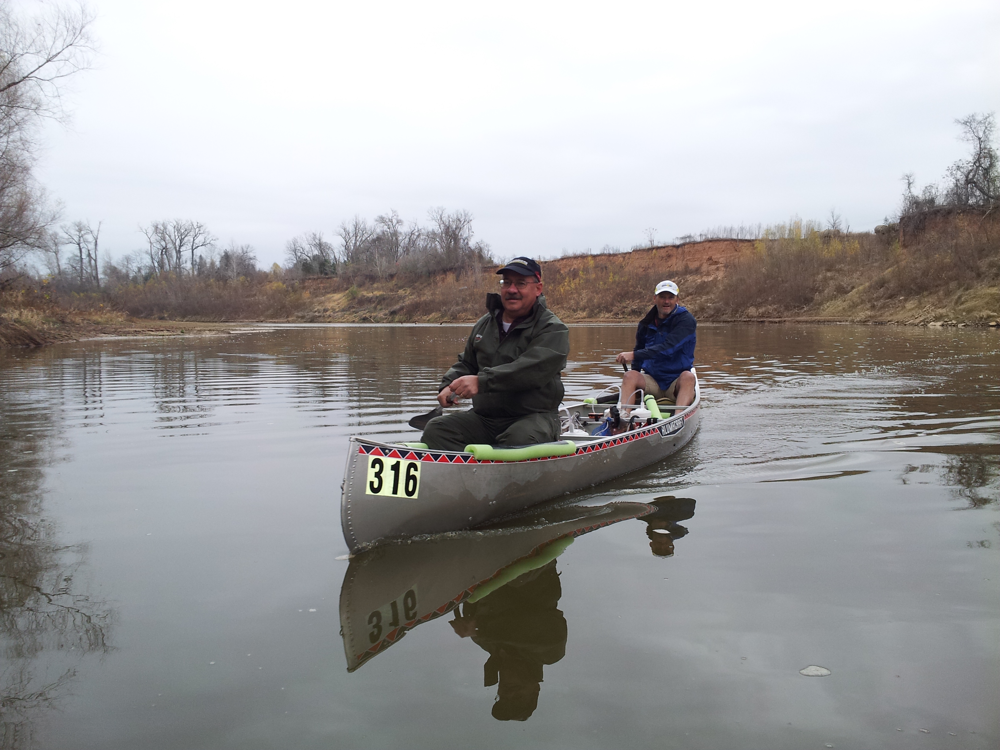
The Neches River Wilderness Canoe Race began more than twenty years ago as a fund-raising event for the Trinity Valley Community College and has earned a reputation as “one of the best organized and most challenging races around.” This fast-paced 22-mile race is organized by the Neches River Runners, a non-profit organization dedicated to conservation and education. The race is held annually on the first Saturday in August.
 The Neches River derives its name from the Caddo Indian word “Nachawi” meaning wood of the bow, a reference to the bois d’arc trees that grow along the river. The Spaniards changed the name of the river to Neches. This flatwater river flows 416 miles through the piney woods of East Texas to Port Neches on the Gulf of Mexico. The Neches race covers 22 grueling miles of the river — and I do mean grueling.
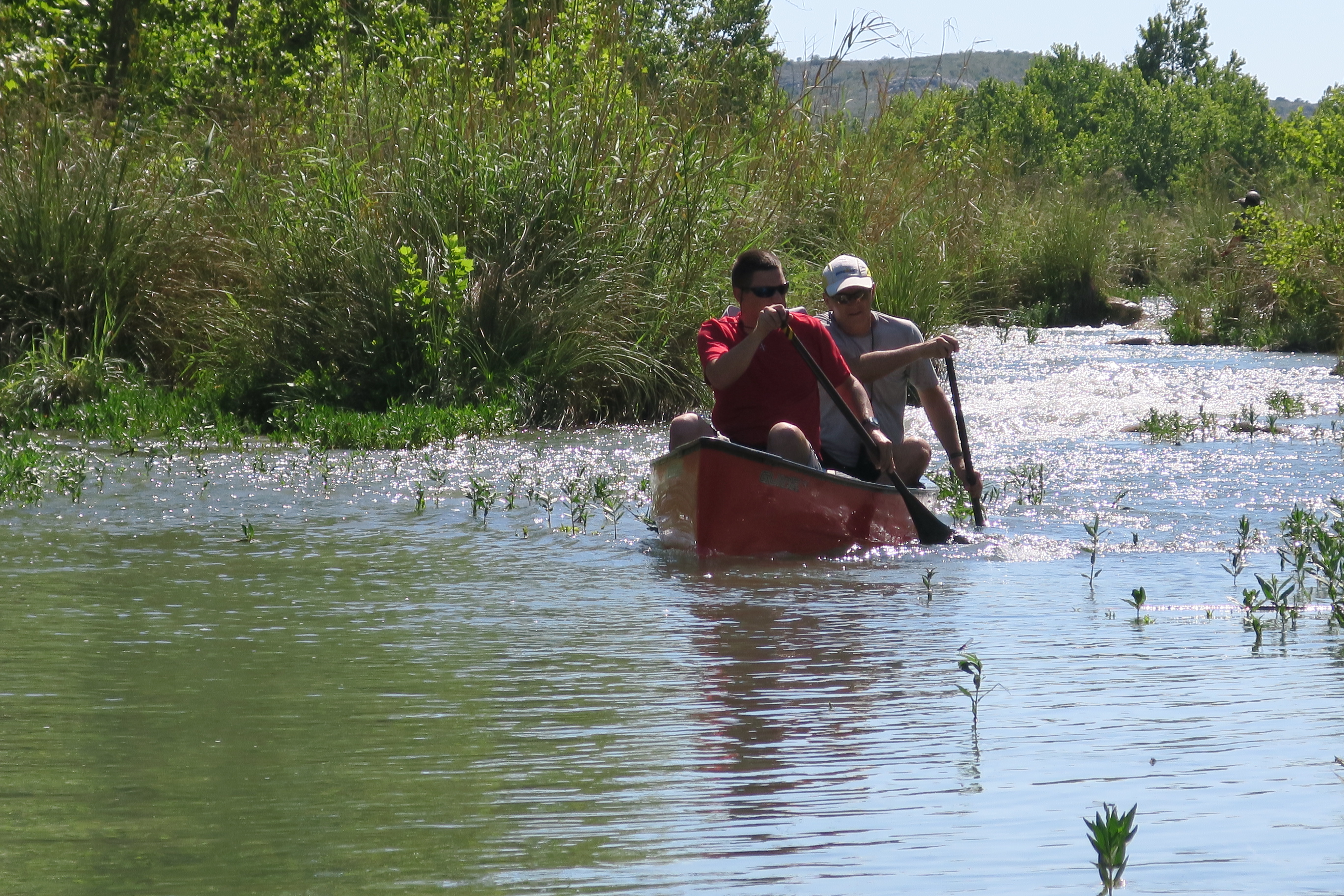
 The Neches race is billed as the toughest little canoe race in Texas. And indeed it is. This is the first marathon canoe race I participated in after my son Jonathan invited me to train with him for the Texas Water Safari, the world’s toughest canoe race. Since then, I have paddled in this race four times. Of all of the marathon canoe races in Texas, this is my favorite. Mile for mile, this little race is filled with a boat-load of challenges, obstacles, and opportunities to get scraped up, beat up, and worn out.

 What makes this race so tough? Imagine what it would be like to be the ball in a pin-ball game for several hours and you will have some idea of what this race is like. The 22-mile race course is littered with fallen trees, submerged logs, and enough spiders, snakes, and other pesky little critters to fill a haunted mansion. Contestants have to navigate these and other obstacles along the way. Some places along the course are so narrow and tight that racers have to queue up just to get through.

 I enjoy being a part of the paddling community in Texas. The Lone Star State offers paddlers some of the best marathon canoe races in the country and some of the most beautiful paddling trails in the world. Whether you paddle to compete or for fun, there are few things better than navigating down our beautiful Texas rivers. Plan to add a paddling excursion to your next Texas adventure. This is one of the best ways to see Texas as many of the early explorers did.

To see more photos and video of the 2016 Neches River Wilderness Canoe Race, please visit Facebook/Lone Star Pastors and Facebook/Explore Texas Blog pages and also Instagram #lsp316 and #exploretexasblog.
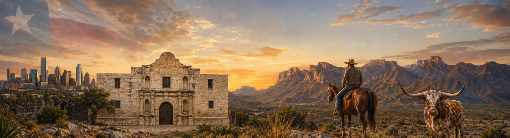
Texas Rivers
The Texas Water Safari
The Texas Water Safari is billed as the world’s toughest canoe race and, to my knowledge, no one who has competed in and finished this ultramarathon race has ever disputed this claim. Contestants must navigate their vessels 260 miles down two Texas rivers and reach the finish line in 100 hours or less.
 To make the course even more challenging, contestants must reach the multiple check points along the route on or before the specified deadline for each respective check point or risk being disqualified. This race is the paddling equivalent of doing ten marathons back-to-back.
 The race starts in San Marcos and follows the beautiful San Marcos River all the way to its confluence with the Guadalupe River in Gonzales. Racers then paddle down the Guadalupe all the way to San Antonio Bay where they must tackle a five-mile crossing to the finish line in Seadrift.
 Someone described the Texas Water Safari as a race from San Marcos to Gonzales and a death march from Gonzales to Seadrift. Having finished this race on each of my two attempts, I agree with this assessment. The finish line is an estimated one quarter of a million paddle strokes from the starting line. That is a lot of paddle strokes!
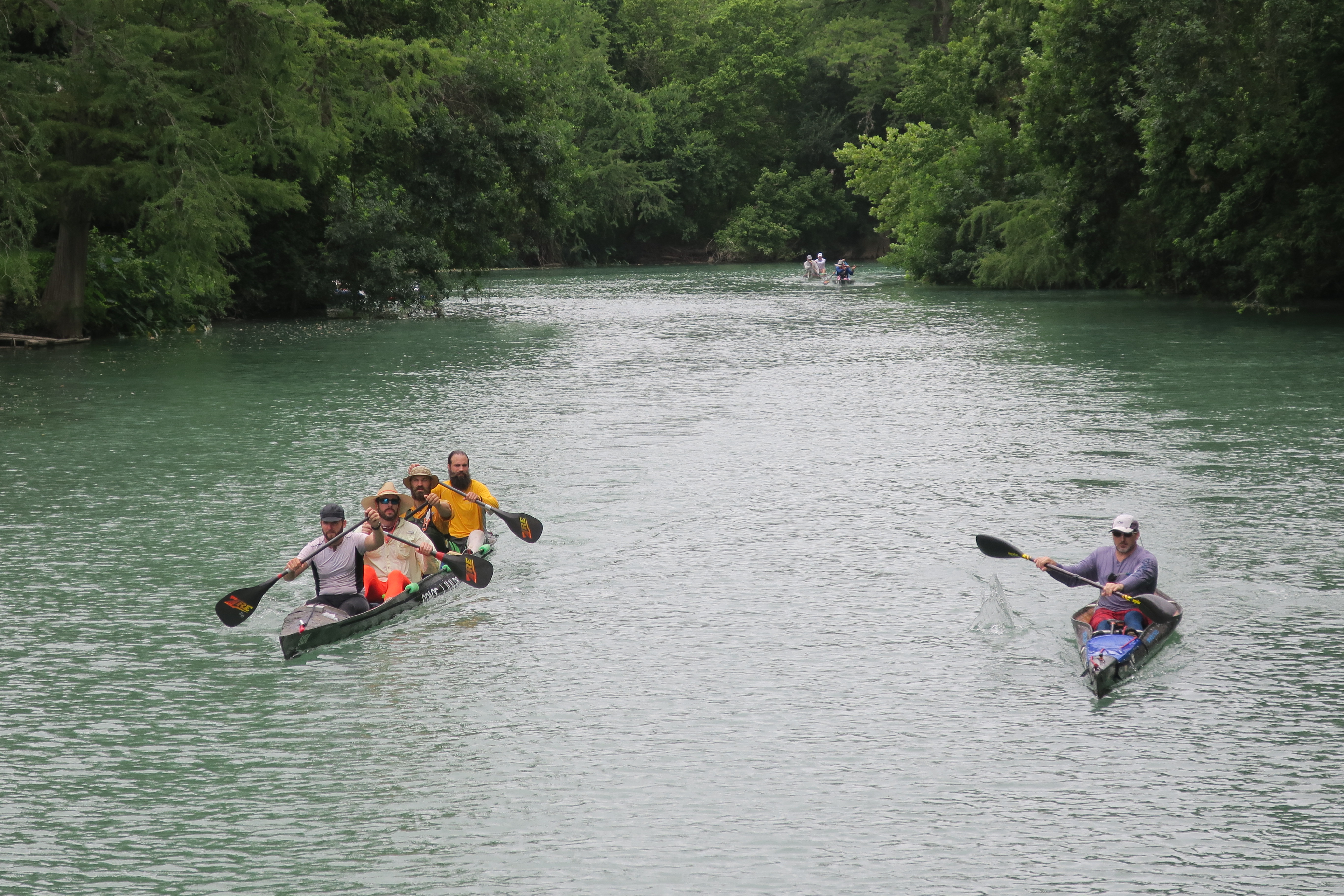
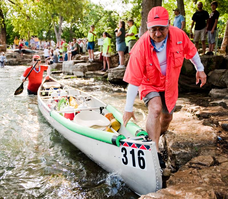 To say there are challenges along the way would be an understatement. In addition to paddling day and night for as many as four days, paddlers must deal with hunger, sleep deprivation, hallucinations, several portages and rapids, and the unexpected challenges the river always presents. Anything can happen along the way to keep you from reaching the finish line — regardless of whether you are a novice or the most experienced paddler.
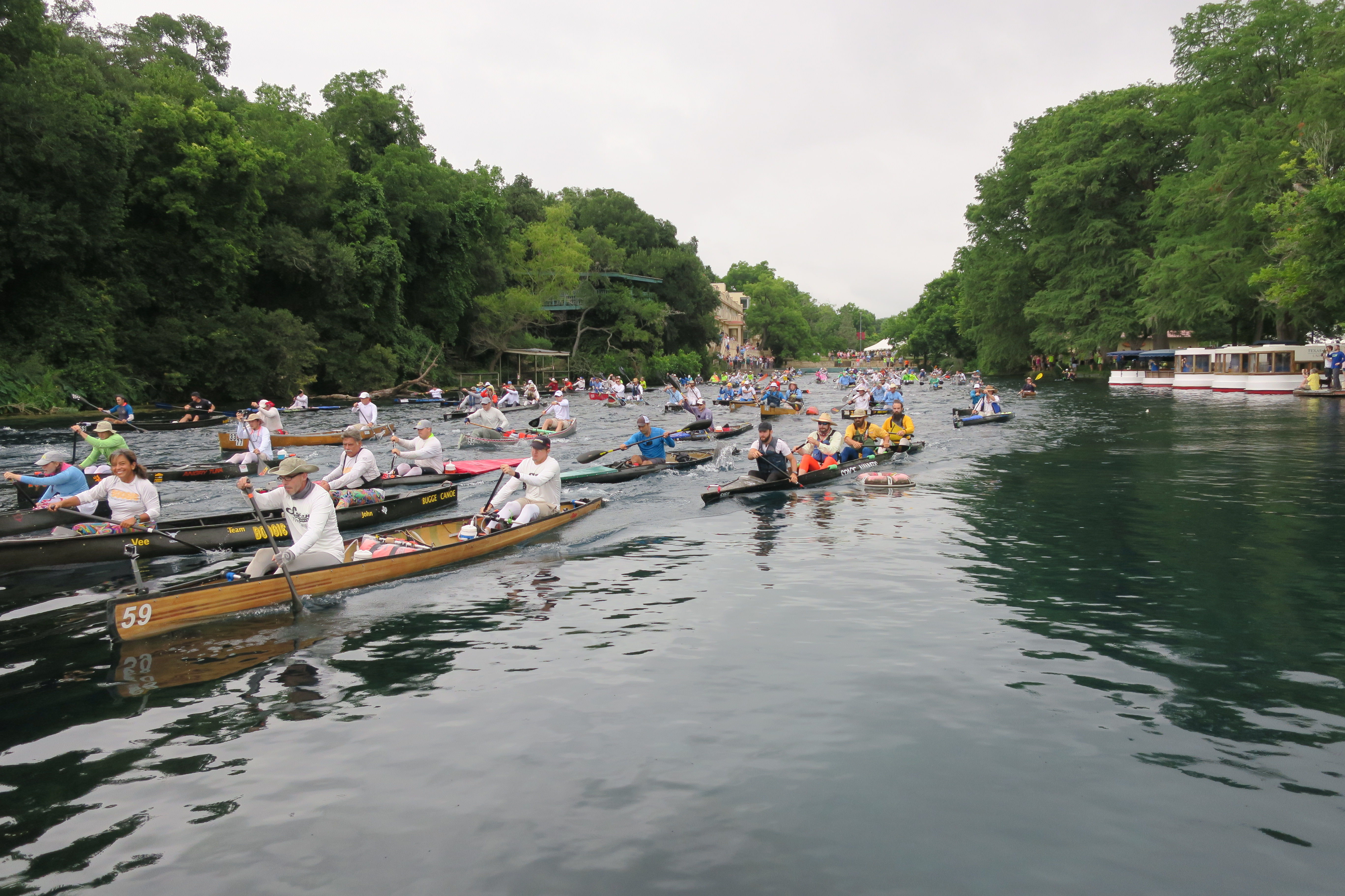
 This truly amazing race is held every June, normally starting on the second Saturday. Last year and this year, race officials were forced to postpone the start of the race because of record rains and floods that made the river dangerous to navigate. But, this morning, under overcast skies, more than one-hundred paddlers stirred the crystal clear waters of the San Marcos River and began their journey toward Seadrift.
 The fastest paddlers will reach the finish line in far less than half the allotted time. Paddlers arrive in Seadrift to the cheers of family, friends, and fellow paddlers all the way through the deadline on Wednesday. The prize — a patch and a plaque that commends you for finishing the world’s toughest canoe race. For me, that was enough. The real reward was sharing the adventure with my son the first year and a friend the second year — and the satisfaction that I had done something really hard.
 The Texas Water Safari is now officially underway. When I go to bed tonight I will do so dreaming about those who will paddle through the night. As with every year, this year’s safari will give us some fascinating stories that will be added to the treasury of stories that are told and retold year after year. I invite you to read Resolve On the River, one of my favorite safari stories.
The Devils River
The Devils River is one of the lesser known rivers in Texas — and that is just fine! Defiantly snaking its way through some of the most rugged terrain in the Lone Star State, this is a river that lives up to its name. Texas Monthly magazine reported, “If the Devils River were a woman, Willie would have married her twice and we would be crying into our beer as he lamented her wicked ways.”
 As a canoeist, the Devils River has been on my list of must-do paddling adventures in Texas. However, paddling on this river requires a bit of research and connecting with the right outfitter. The river flows through private ranches whose owners do not allow camping on the long riparian stretches of their big backyards. This also means that there are few public take-out sites along the way. So, careful planning is essential.
 The Texas Parks and Wildlife Department cautions that a trip on the Devils River is suitable only for experienced paddlers who are prepared to spend more than a day on the river. There are a number of Class I and Class II rapids, deep pools, strong headwinds, rocky shallows, and dense canebrakes along the route. Knowing how to pick your line and when to apply a good draw stroke are vital to successfully navigating the rocky rapids.
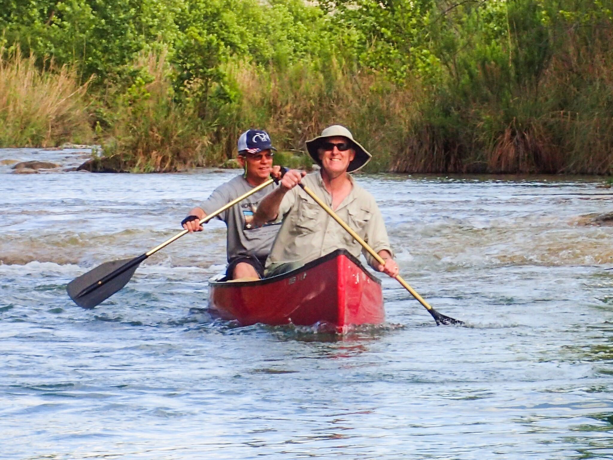
 My dream of paddling the Devils River became a reality through the generosity of some dear friends. The best part about it was the opportunity to share this adventure with my son Jonathan and a few of our paddling friends. Our team traveled to Rocker U Ranch where Dougal and Cathy Cameron welcomed us with the warmest of Texas hospitality. Their beautiful ranch sits along a three-mile stretch of the Devils River below Baker’s Crossing.
 Dougal, a real estate professional, is no stranger to the Devils River. Although not an outfitter by trade, he understands the pulse of this waterway, how to navigate through the confusing canebrakes, the best islands for camping (since you are not allowed to camp along the banks), the warning signs that indicate the potential for a flash flood, and the fascinating history of the river. He is an excellent paddler and proved to be the perfect guide.
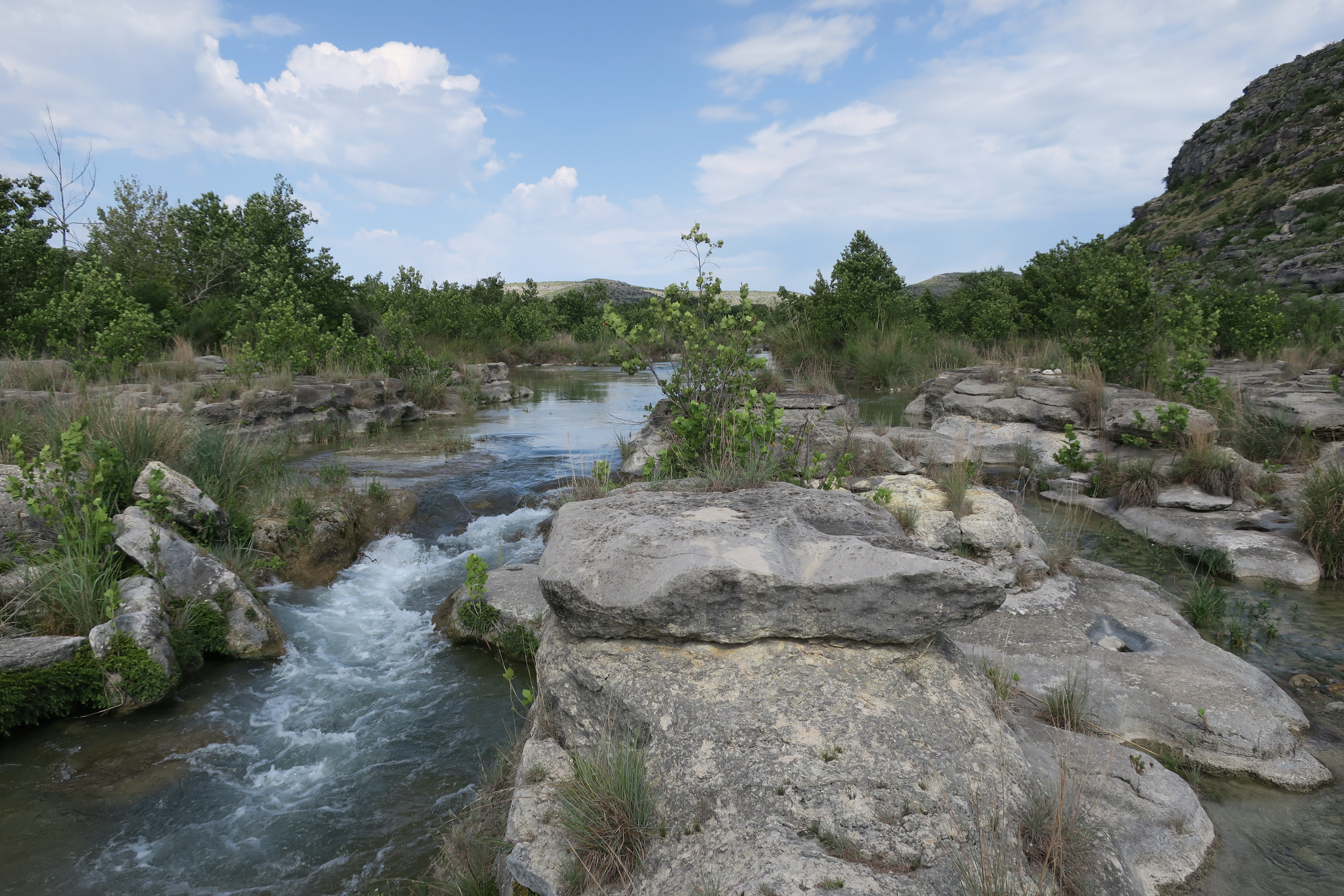
 Dougal led us from his ranch all the way to the magnificent Dolan Falls, a 10-foot Class IV waterfall about 16.4 miles downstream from Baker’s Crossing. Dolan Falls is the largest continuously flowing waterfall in Texas. At the bottom of the falls is a deep blue swimming hole — a perfect place for jumping in from the smooth overhead crag. Our guys could not resist the temptation to dive in.
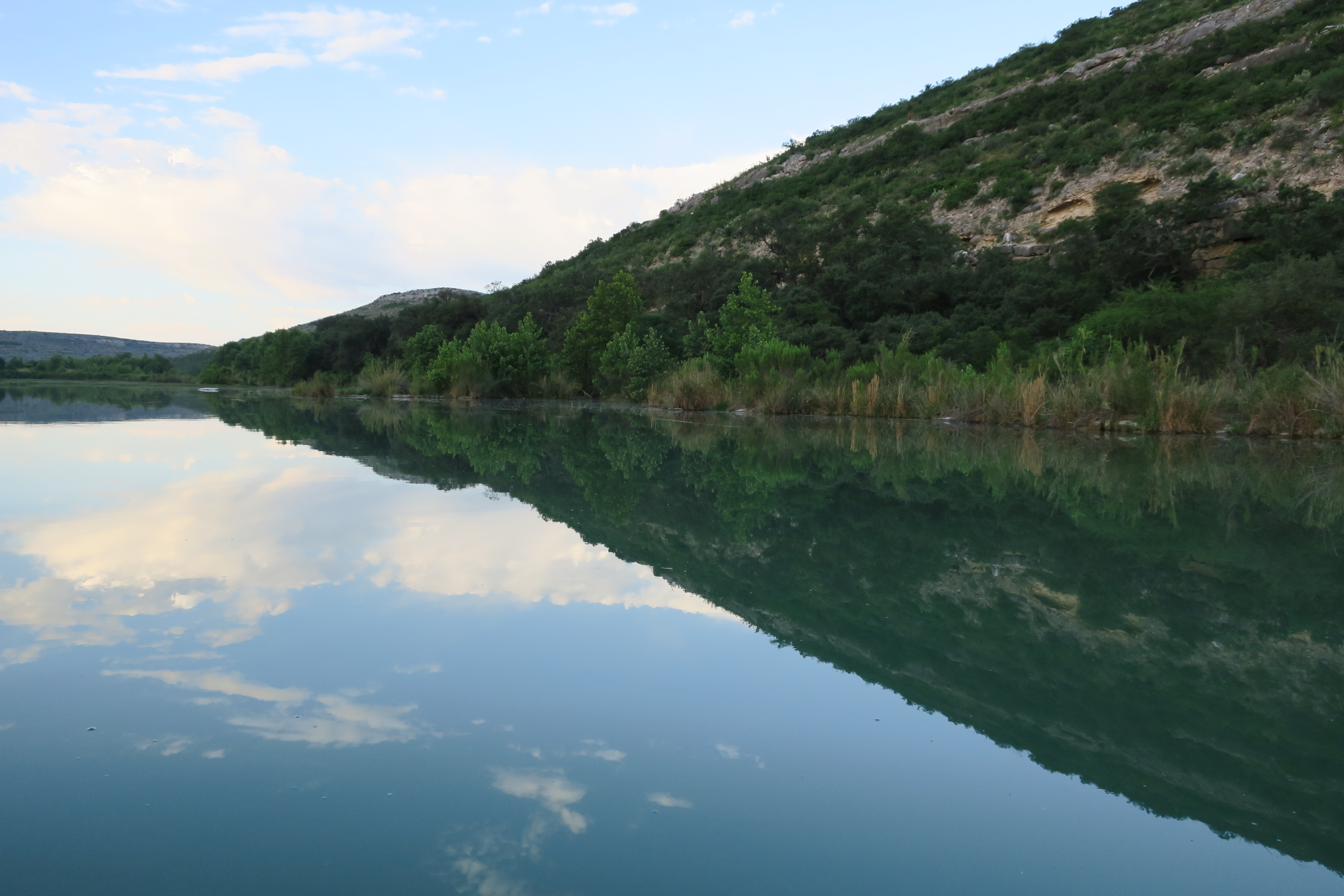
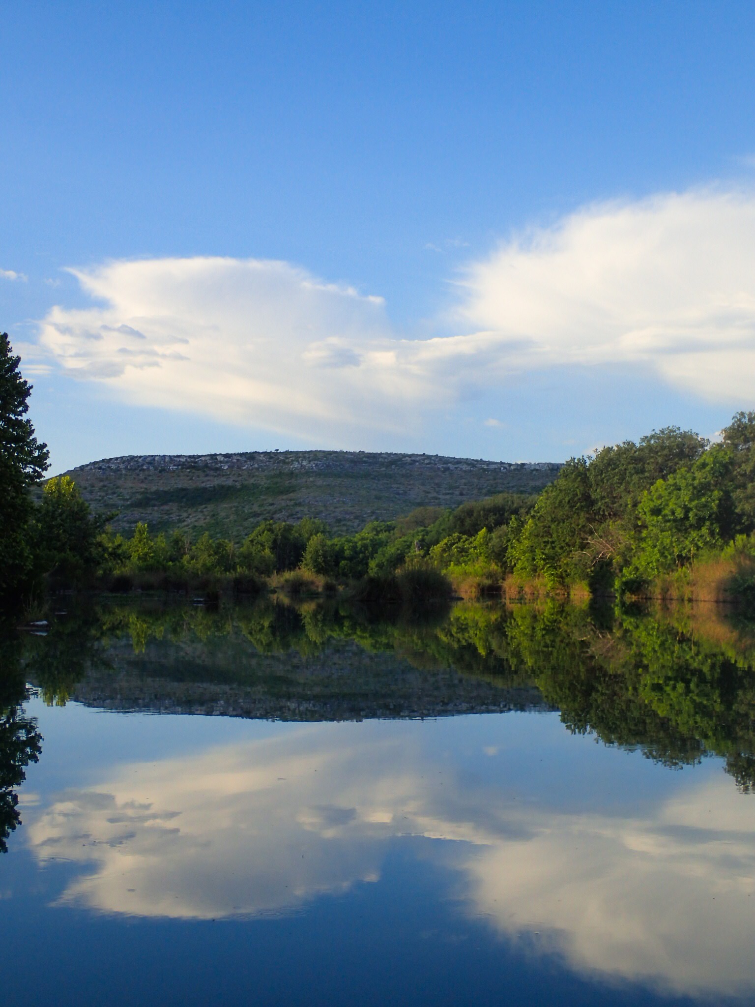 The Devils River is regarded as the most pristine river in Texas. And indeed it is. We saw absolutely not one scrap of trash along the way. The spring-fed water was a consistent turquoise and blue, and clear all the way to the bottom. In fact, we filled our water bottles from the river and drank it unfiltered. Not many places left where you can do that!
 The banks of the river are lined with elm, sycamore, live oak, pecan, mountain laurel, and a variety of other trees and shrubs. The hills on either side are pockmarked with natural caves that beg to be explored. Dougal has found numerous arrowheads along the river banks on his property, an indication that native Americans once lived along this river.
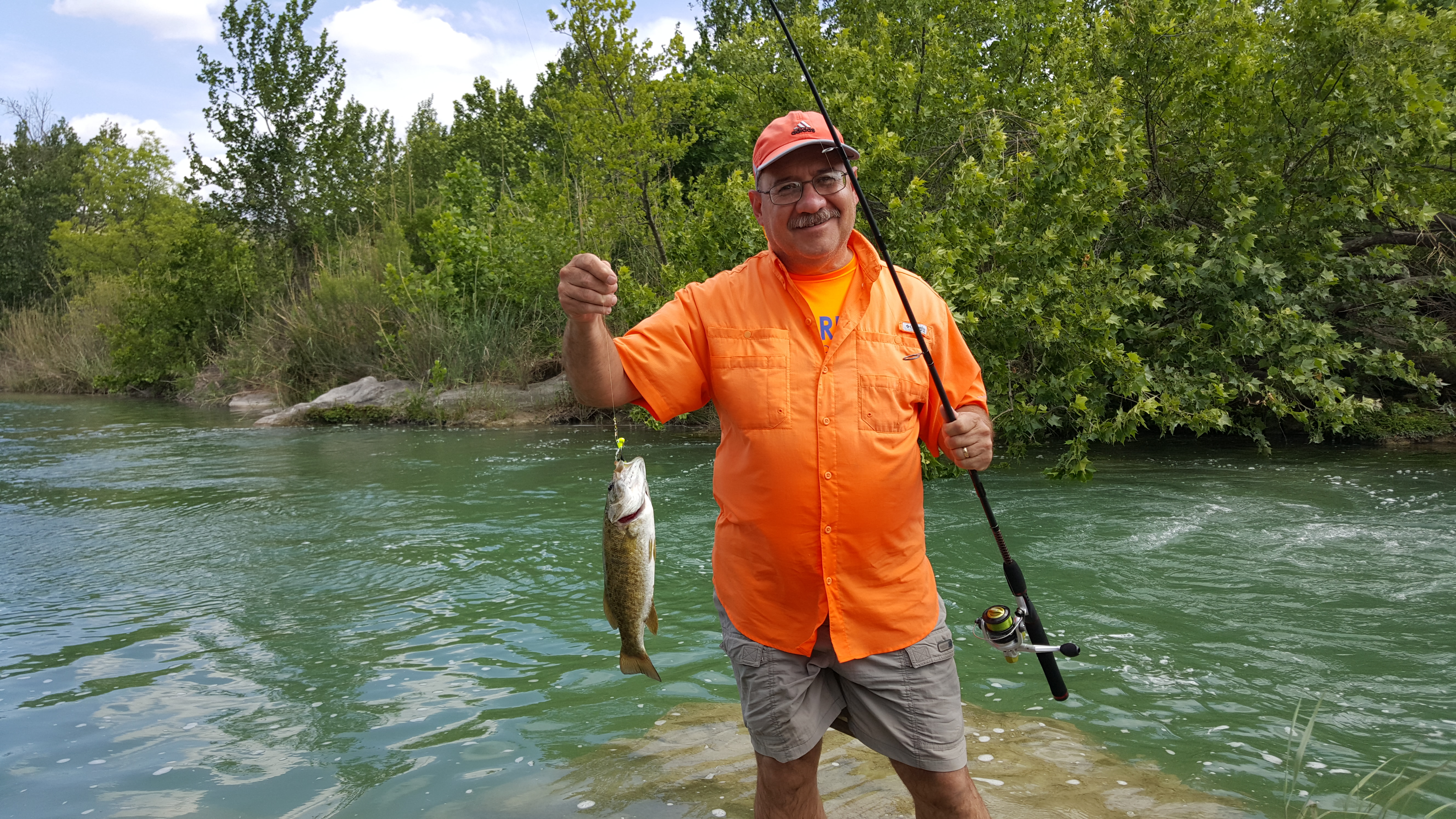 We did have an opportunity to fish along the way and caught and released several large and smallmouth bass. We spent the night on Game Warden Rock in the middle of the river. That was a cool experience. We slept under the stars and enjoyed an amazing display of thunder and lightning off in the distance. Jonathan summed it up by saying that while we may not have slept like a rock it was really cool sleeping on a rock.
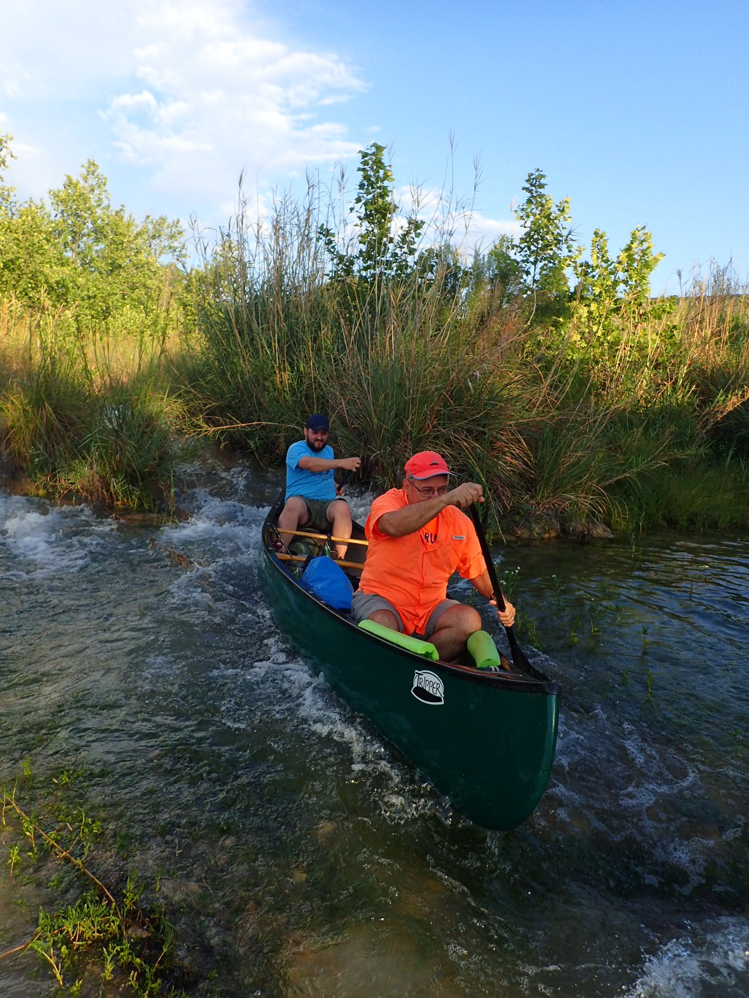 From Dolan Falls, we did something that I doubt few, if any, other paddlers have done. We paddled up river back to Dougal’s place. That meant, of course, portaging the many rapids and rocky shallows on the way back. No problem! This made for a great adventure and we actually made good time. We arrived back at Rocker U Ranch in time for a late lunch followed by a sumptuous evening meal. And we arrived with deep gratitude for having shared an adventure of a lifetime.
 The Devils River is a Texas treasure because of the efforts of the Nature Conservancy and local ranchers to protect the surrounding watershed, including nearly 150,000 acres in the Devils River basin. Paddlers must also do their part to protect this river. To learn more about preparing for a Devils River trip, visit the Texas Parks and Wildlife Department’s webpage. If you have an opportunity to visit the Devils River, I think you’ll agree that it is indeed a paddlers paradise.
The Regency Bridge
Bridges. I love bridges. There is something inherently beautiful about these structures that are designed to connect people and places. Over my years of traveling the world, I have crossed some of the most beautiful bridges on the planet and cautiously ventured across others.
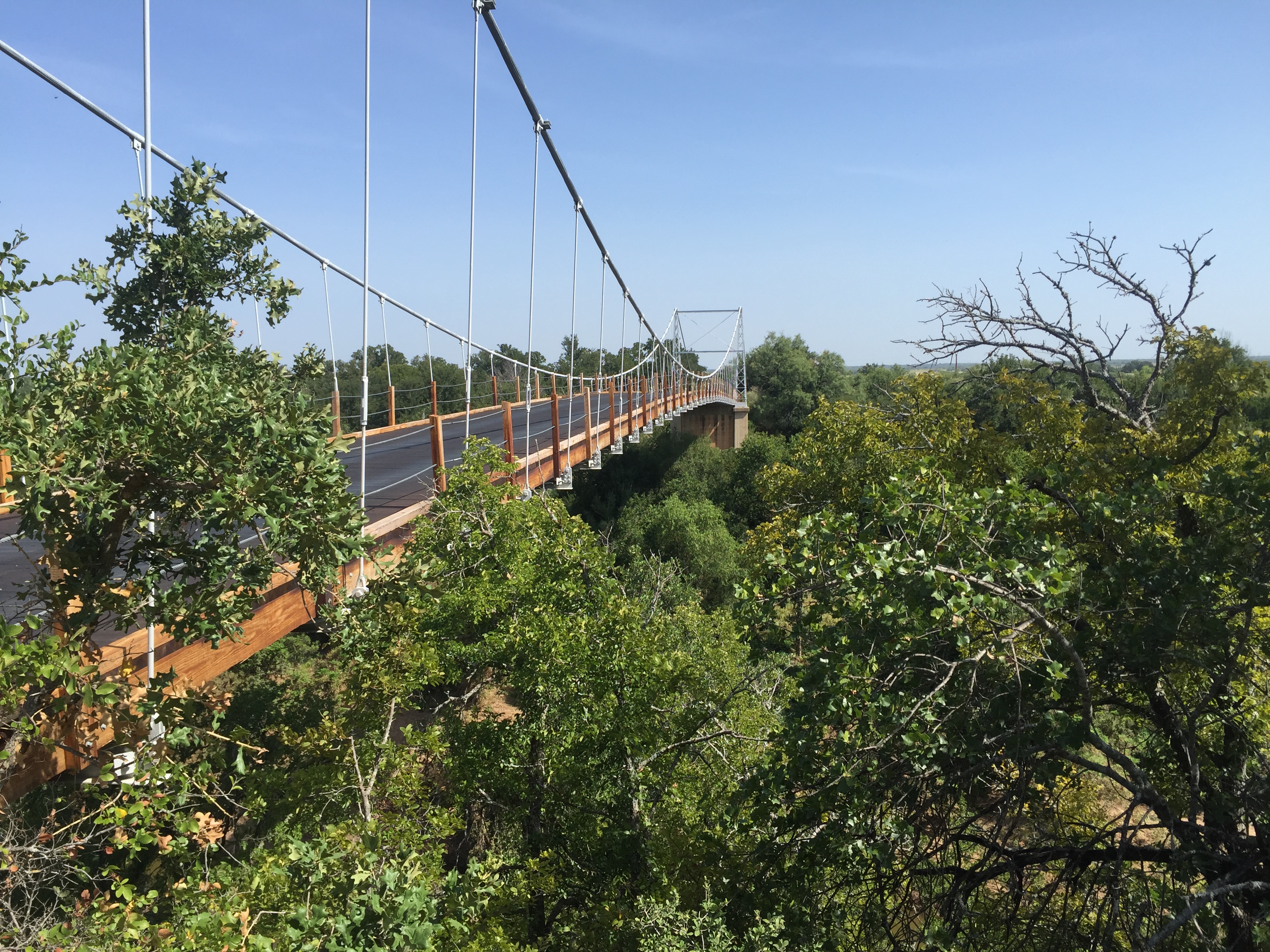
 As a fan of Texas Country Reporter, I have long been fascinated by the one-lane suspension bridge featured in the opening segment of the show — the Regency Bridge. This beautiful bridge spans a remote section of the Colorado River on the Mills-San Saba County line.
 It is, perhaps, a little known fact that Texas has more bridges than any other state in the Union. And, of the more than 52,000 bridges in the Lone Star State, the Regency Bridge is the last suspension bridge in the State that is open to automobile traffic. That alone makes it worth a visit.
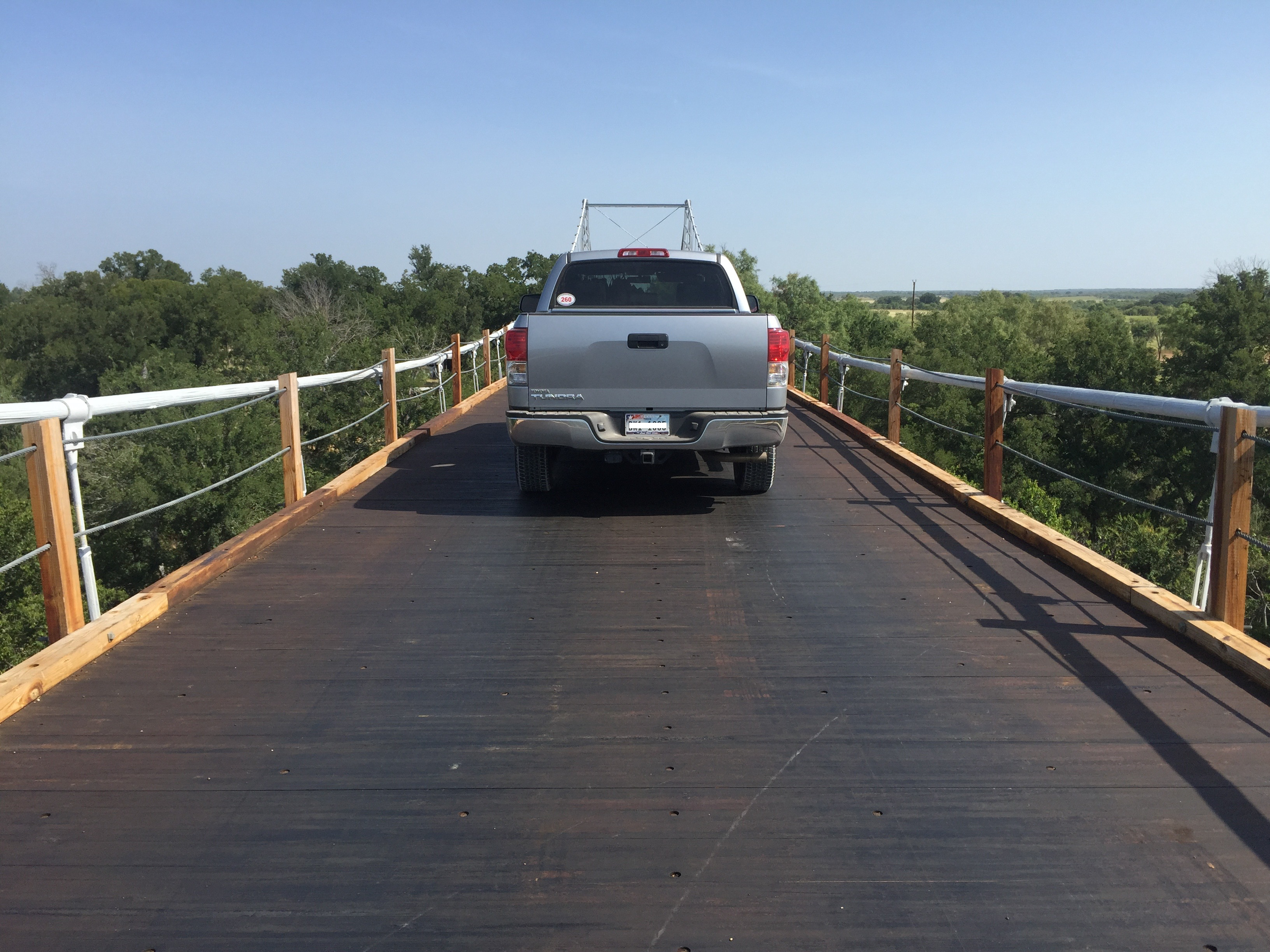 The iconic suspension bridge gets its name from Regency, a now-abandoned farming community on the Mills County side of the Colorado River. The first bridge built at the location in 1903 collapsed under the weight of a herd of cattle. A second bridge was destroyed by a flood in 1936.
 The current Regency Bridge was built in 1939 and repaired and rededicated in 1999. In December 2003, kids shooting off fireworks accidentally started a fire on the wood decking, burning a hole in some of the planks. The bridge was repaired and today remains open to vehicular traffic.
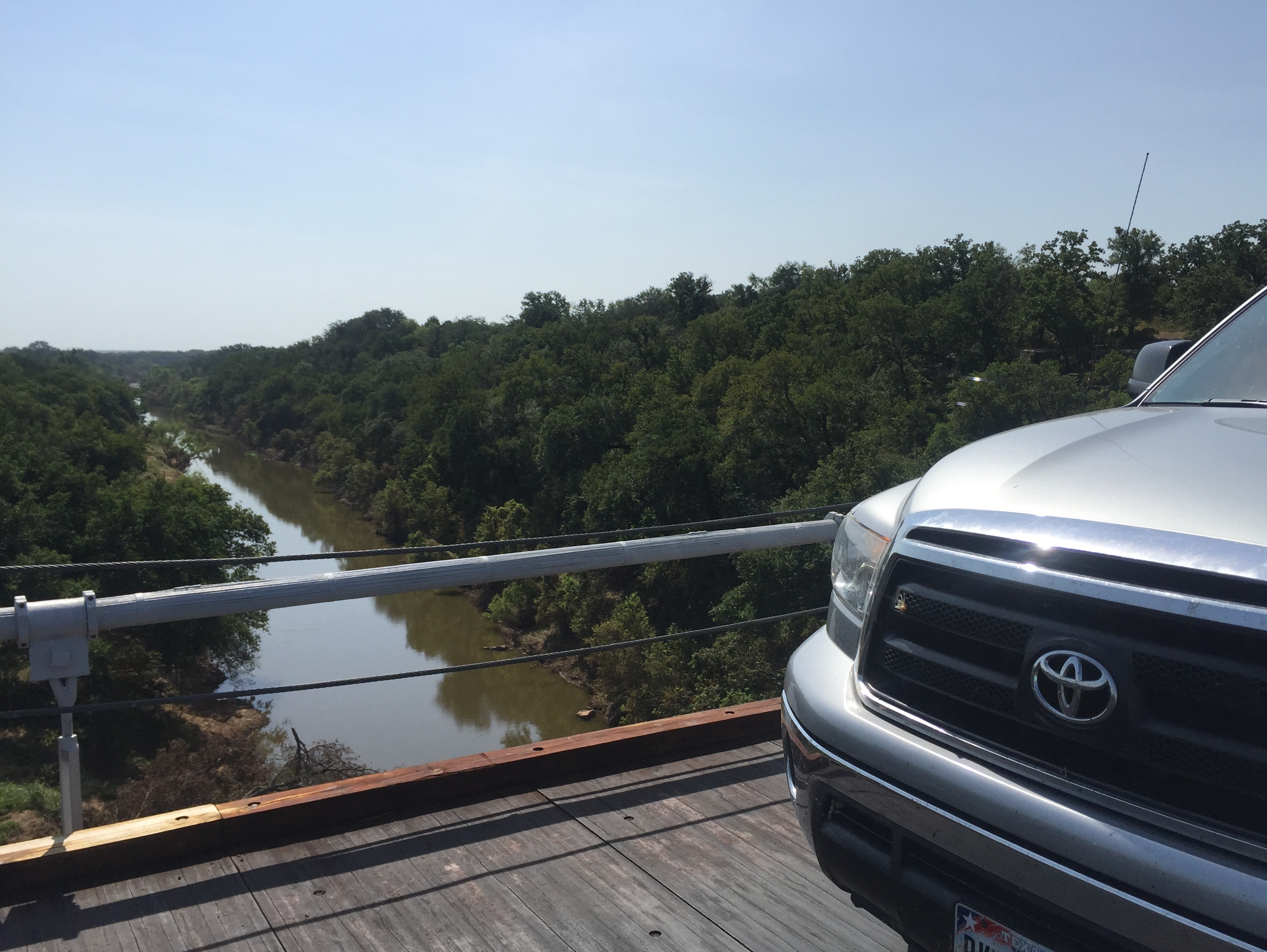 The Regency Bridge is located at the intersection of Mills County Road 433 and San Saba County Road 137, both gravel roads. There is room to park on the Mills and San Saba sides of the bridge. The views from the bridge of the Colorado River and the surrounding countryside are absolutely beautiful.
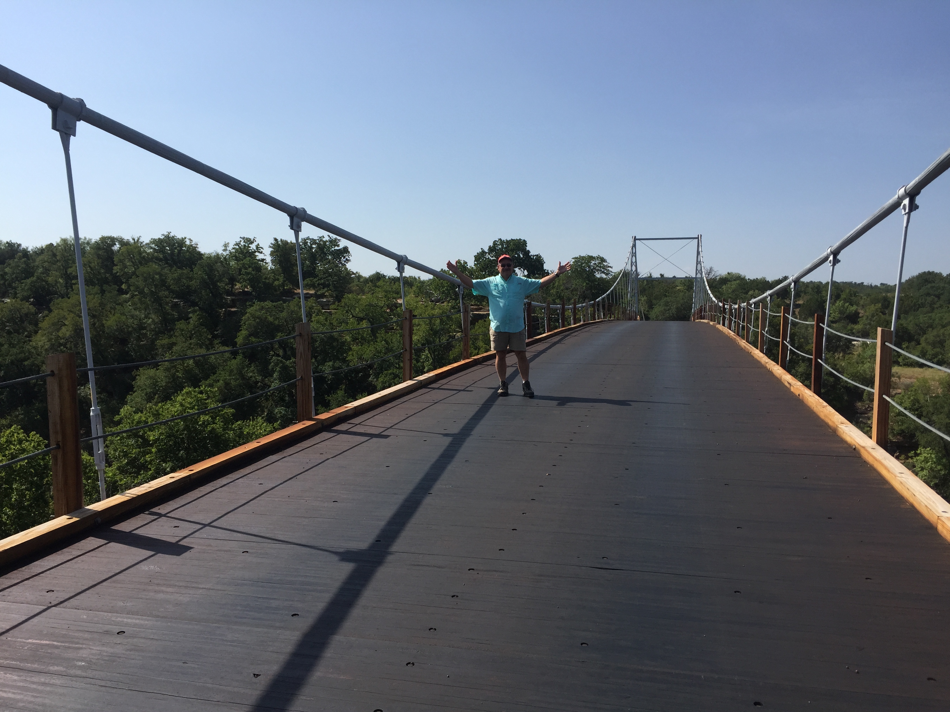 If you find yourself anywhere near the Regency Bridge, make it a point to take a detour to drive across the bridge and to stop and enjoy the scenery. The bridge does not get much traffic because it has been bypassed by newer paved farm to market roads. That makes it even better and possible to enjoy the bridge and the vistas for long uninterrupted periods.
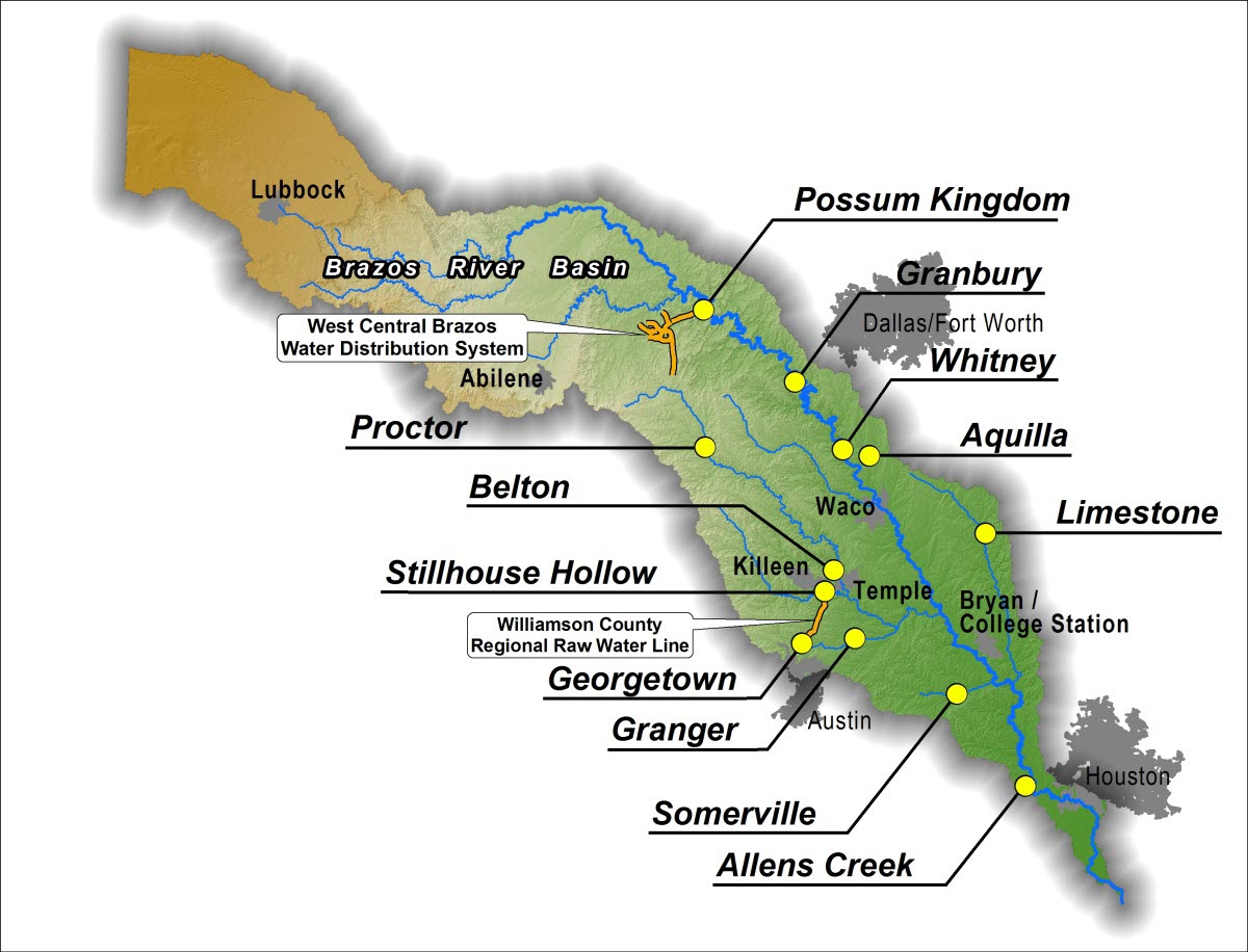
The Brazos River
The Brazos is the longest river in the Lone Start State and one rich in history. The name of this 840-mile long waterway comes from the Spanish word for “arms.” Early Spanish explorers named this wide and slow-moving river Rio de Los Brazos de Dios — translated “The Arms of God River.”
 There are several legends about how the Brazos got its name. However, the common denominator among these stories is that thirsty explorers happened upon the river in the nick of time and were refreshed by its waters. These intrepid souls felt as though they had stumbled into the arms of God and were saved!
San Felipe de Austin, founded in 1824 by Stephen F. Austin, was the first permanent settlement along the Brazos River. Located on a high and easily defensible bluff near the Brazos River, San Felipe became the unofficial capital of Austin’s colony. The town was later incorporated in 1837 and became the county seat of the newly established Austin County.
 The nearby town of Washington, also known as Washington-on-the-Brazos, is recognized as the birthplace of Texas. It’s where Texas became Texas. On March 2, 1836, fifty-nine delegates met at Washington to make a formal declaration of independence from Mexico and birthed the Republic of Texas. Today, visitors to the Washington-on-the Brazos State Historic Site can walk through Independence Hall, the simple frame building where the fate of Texas was determined.
 In the early years of Texas, the Brazos River was navigable from the Gulf all the way to Washington. Today, canoeists and kayakers enjoy paddling the slow flat waters of the historic Brazos River. Over the past few years I have enjoyed paddling on the Brazos as well as just relaxing on its banks as it flows past Stephen F. Austin and Brazos Bend State Parks. These parks afford bikers and hikers some exceptional views of the Brazos.
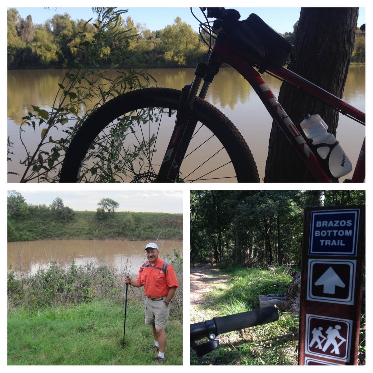 The next time you drive across Texas and cross over the Brazos, take a moment to reflect on the long and rich history of the longest waterway in the Lone Star State. If you have time, visit one of the parks near the river and bike or hike the trails that overlook this magnificent waterway. And be sure to slow down and make time to relax, reflect, and enjoy the quiet when you visit the Brazos. Enjoy the embrace of Los Brazos de Dios.
