Guadalupe Peak 4.0

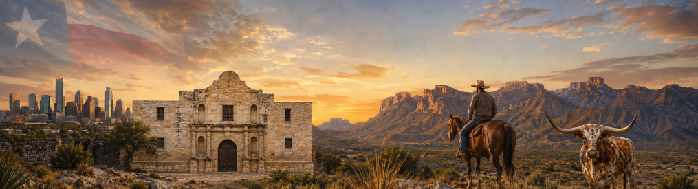
I stood at the top of Texas for the very first time four years ago. In search of my next adventure, I had researched Guadalupe Peak and then set off to solo hike to the summit on a cold December morning. And what an amazing adventure it was!

I summited Guadalupe Peak a second time and then a third time after bushwhacking to the summit of El Capitan. Since I was in the neighborhood and so close to the peak, a buddy and I decided to go for the peak, a third summit for both of us.

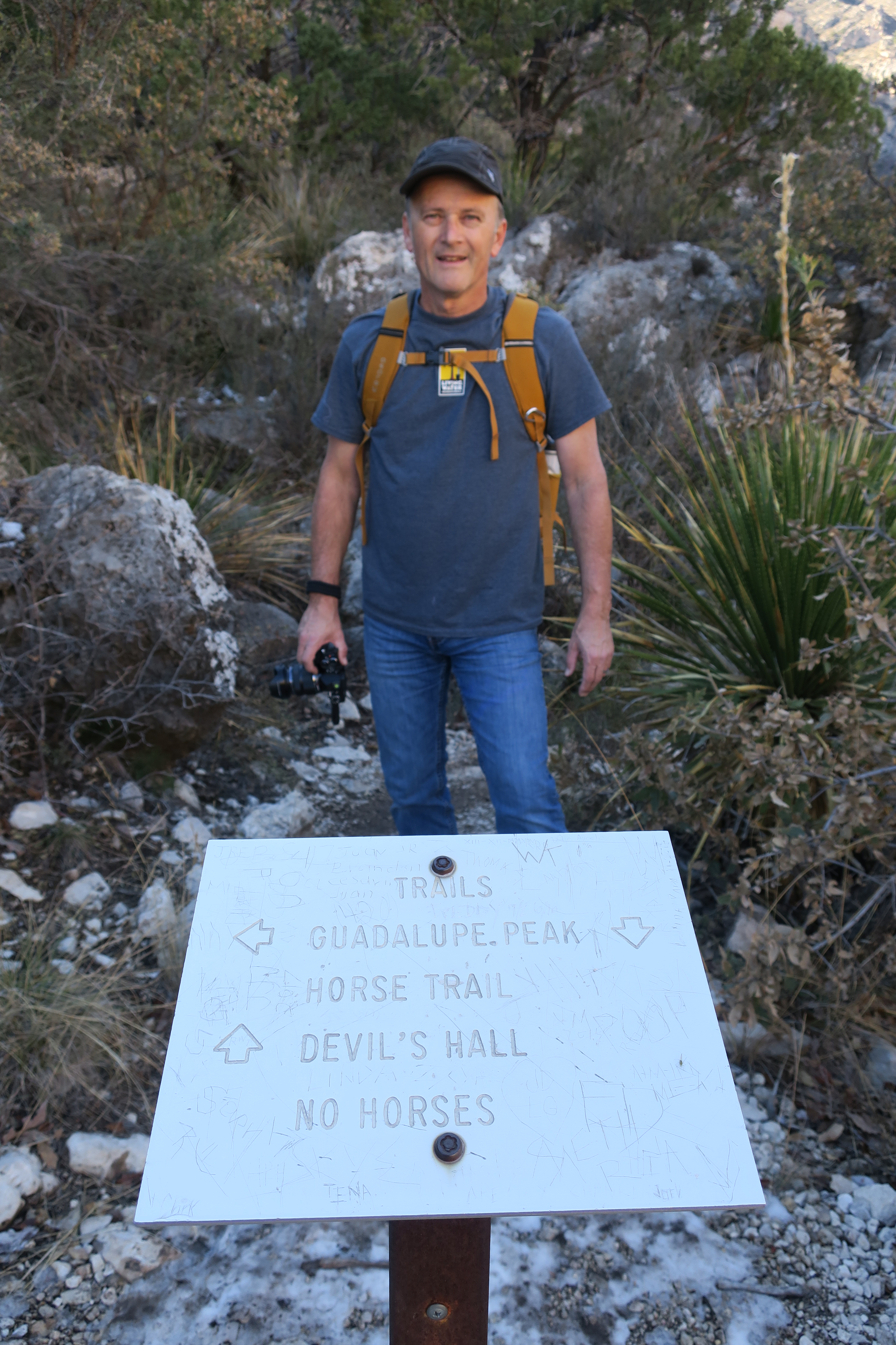
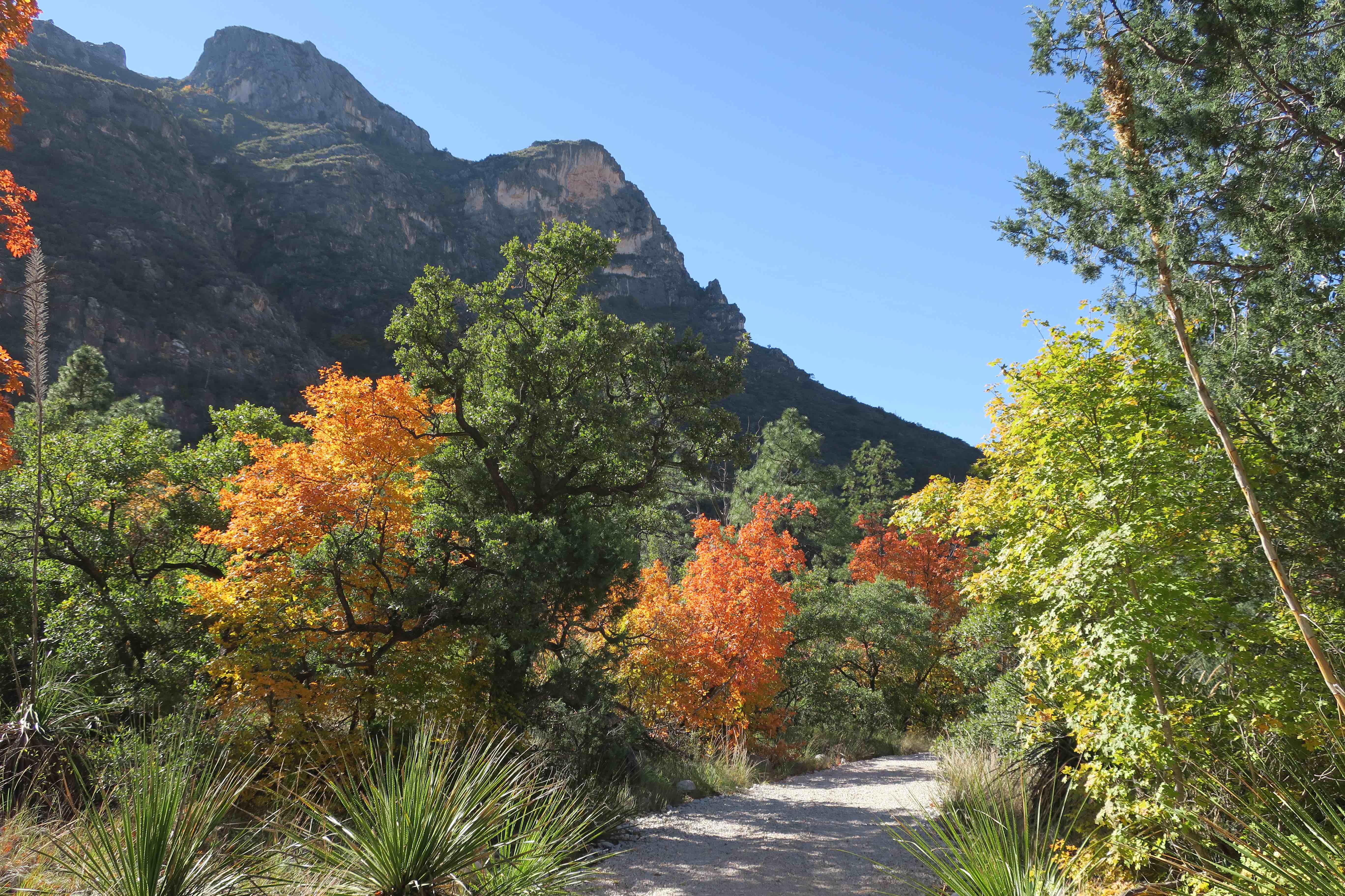
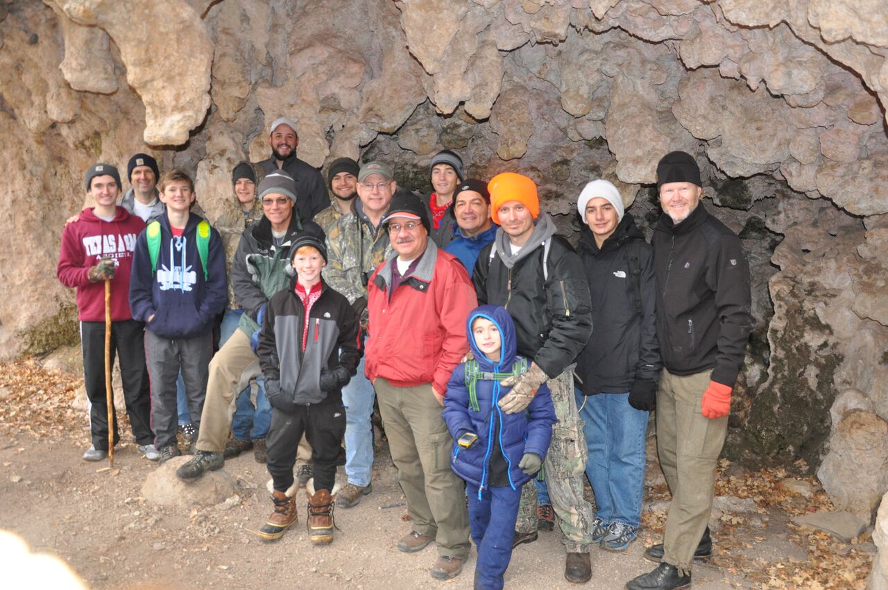
This month, I led a group of men and boys from my church to Guadalupe Mountains National Park to do something hard. We drove six-hundred and fifty miles for the opportunity to stand at the top of Texas.

In preparation, I had told the group that hiking Guadalupe Peak is hard. The hike along the steep and winding trail to the top is rated as strenuous. I knew for a fact that it would not be any less strenuous for me on my fourth bid.
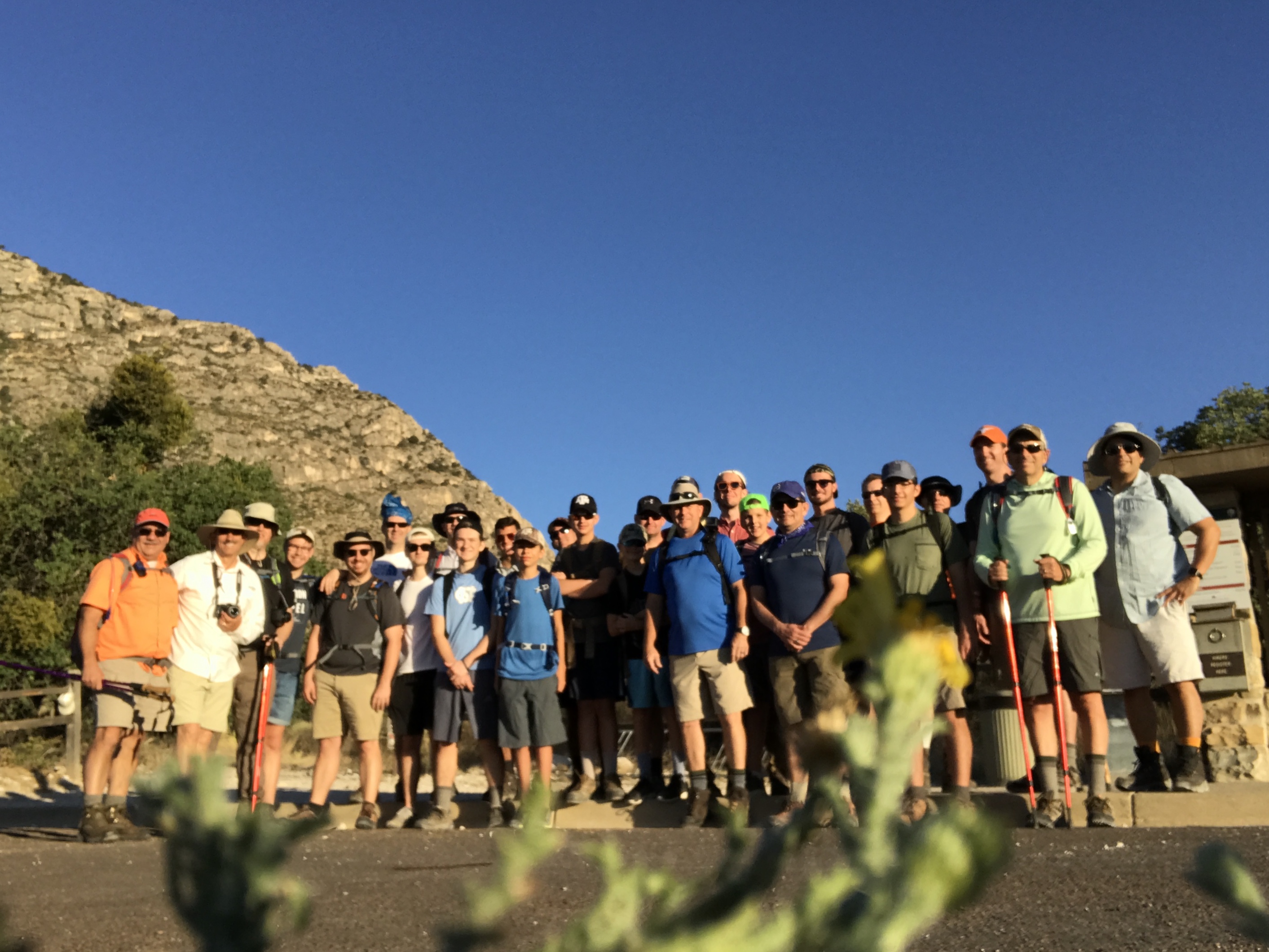
We met at the trailhead at 6:30 in the morning while temperatures were still tolerable. Huge amounts of excitement swirled in the morning breeze and mixed with bits of anxiety as we waited like race cars with engines revved high.

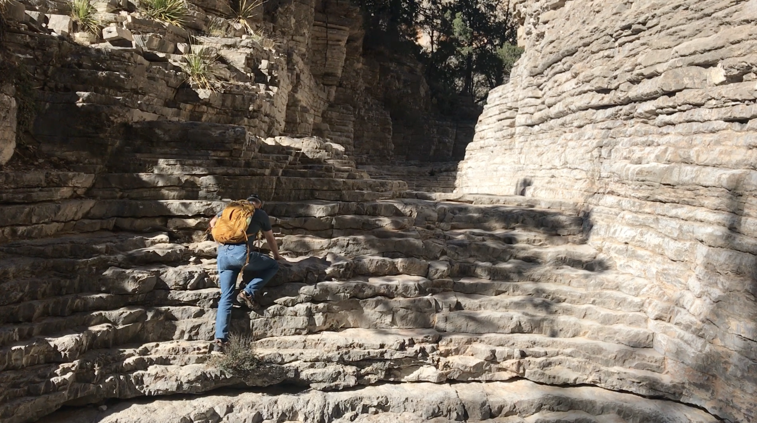
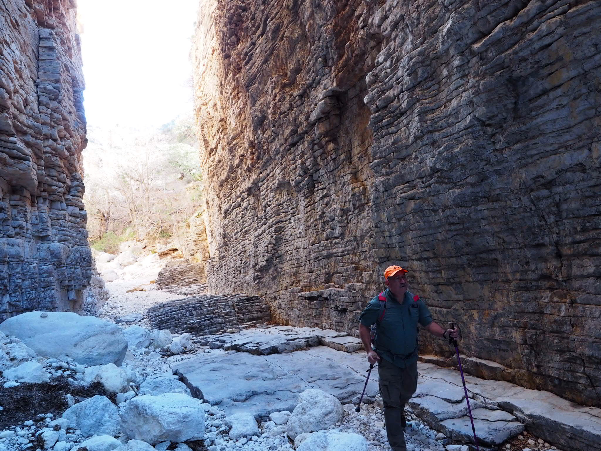
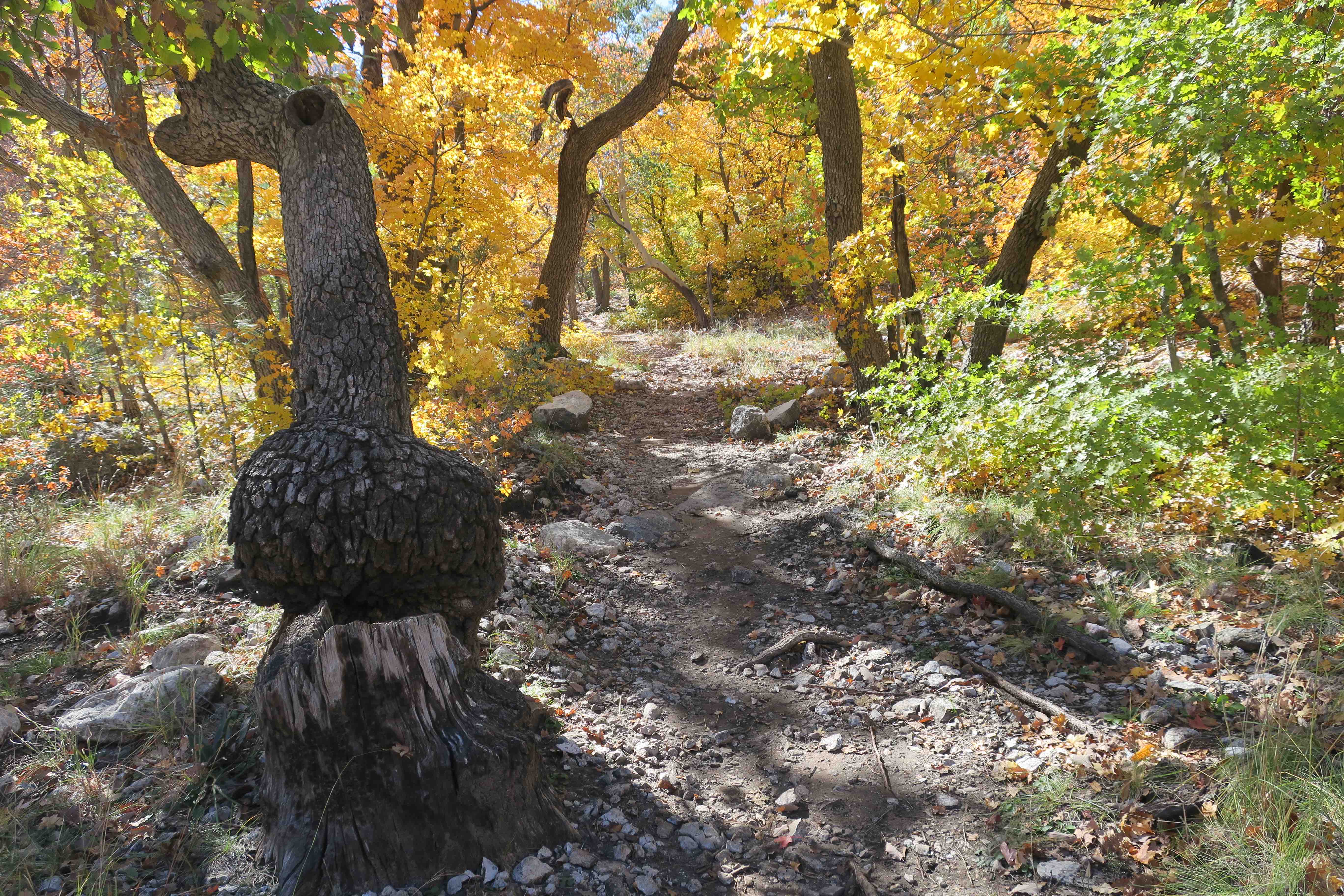
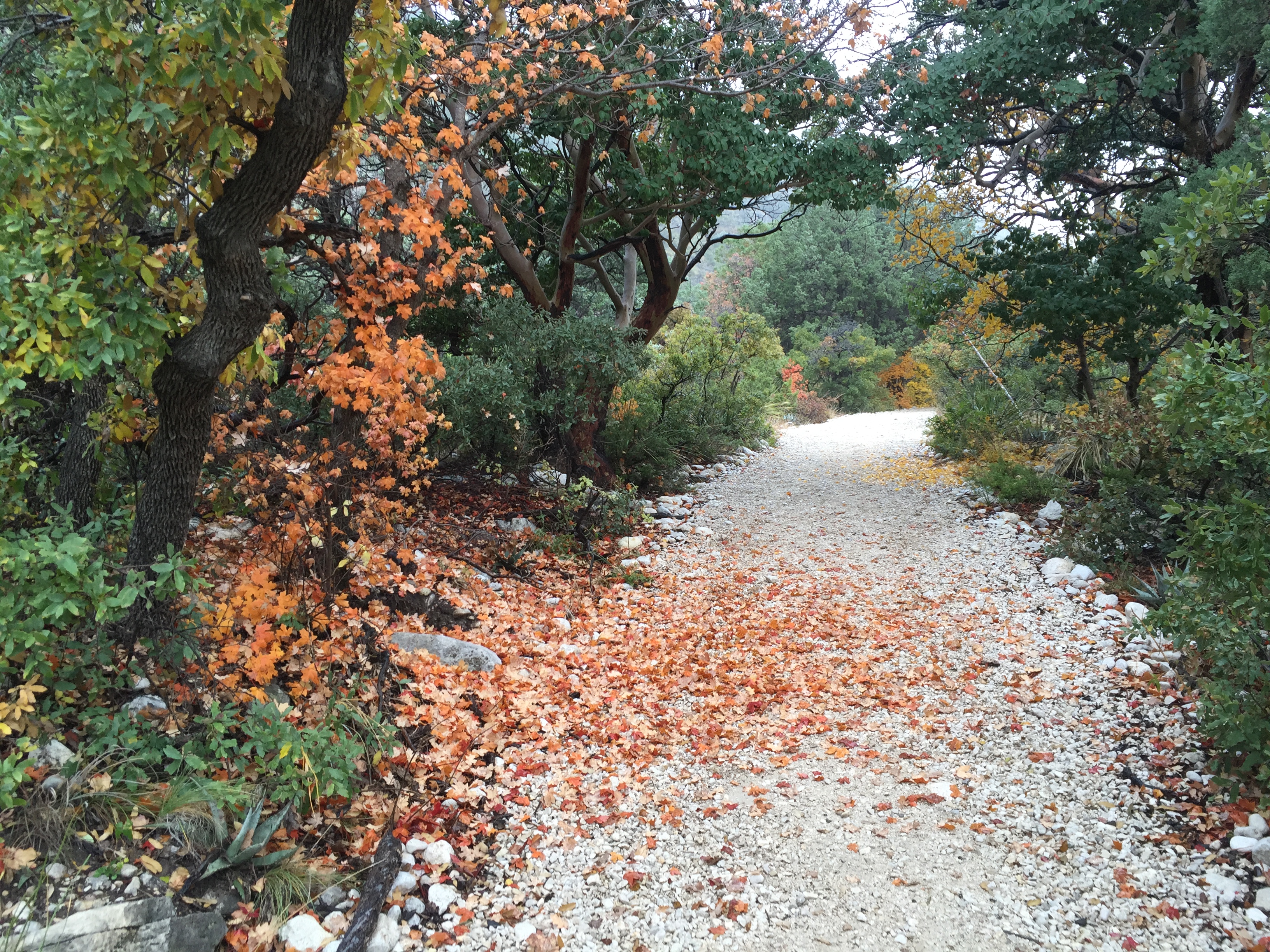
We took a moment to share final thoughts about our adventure, we prayed, and then we hit the trail. Every guy knew that the first mile and a half would be the hardest because of the steep elevation gain.
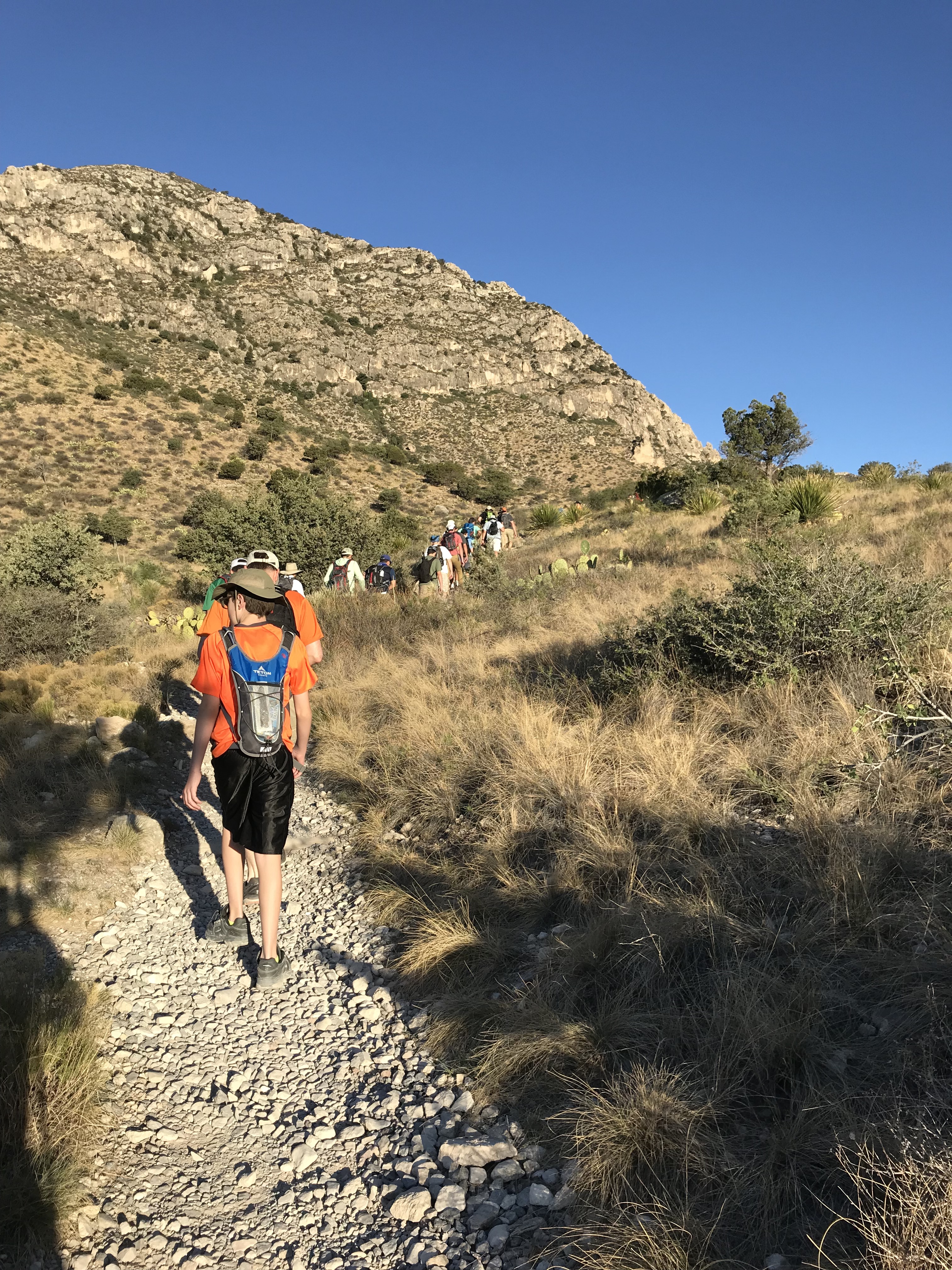
Like a brick wall, the first mile and a half stop those who are either unprepared or don’t want to summit badly enough. This is where we have to decide whether we are willing to push past the pain.

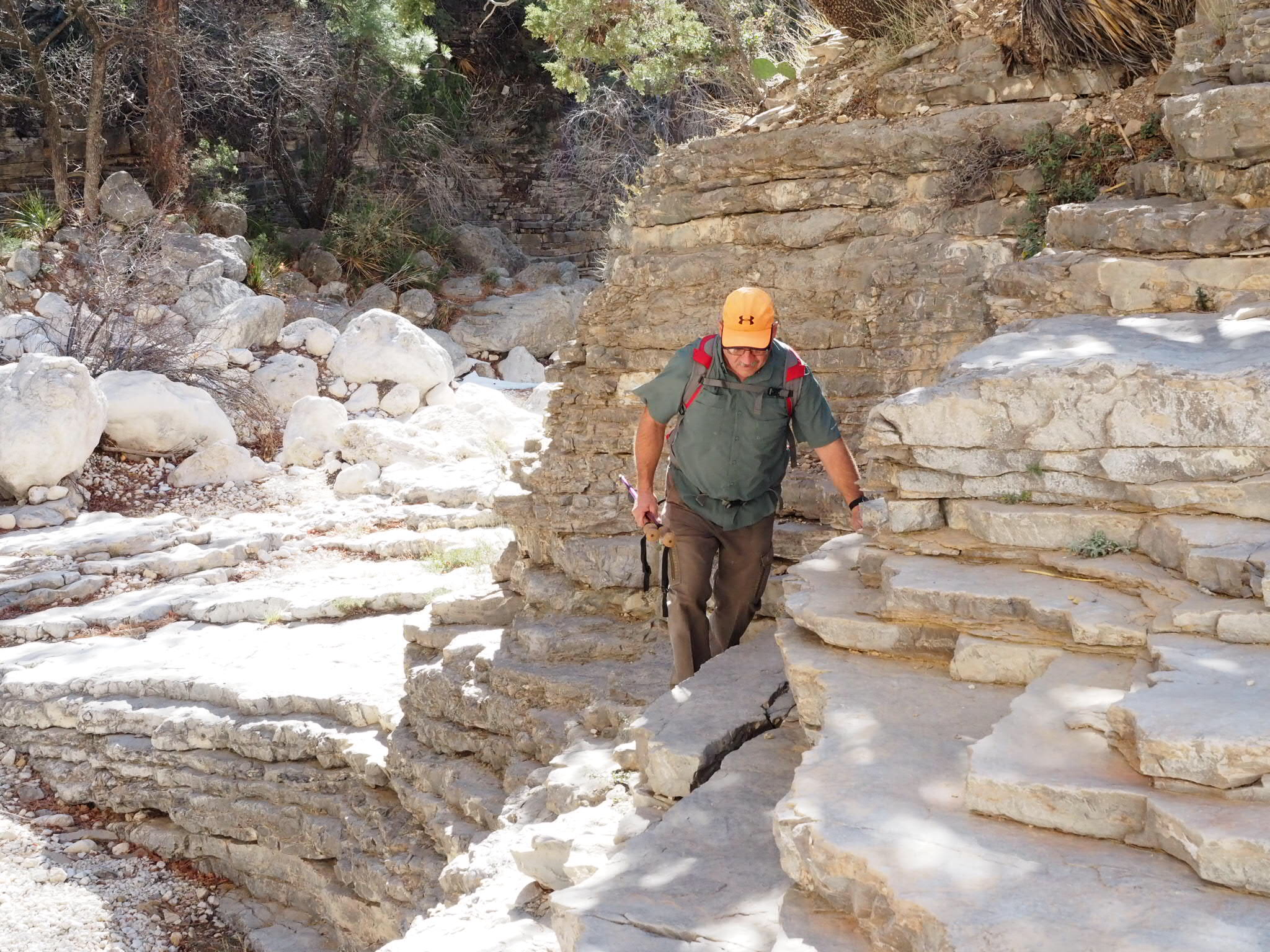
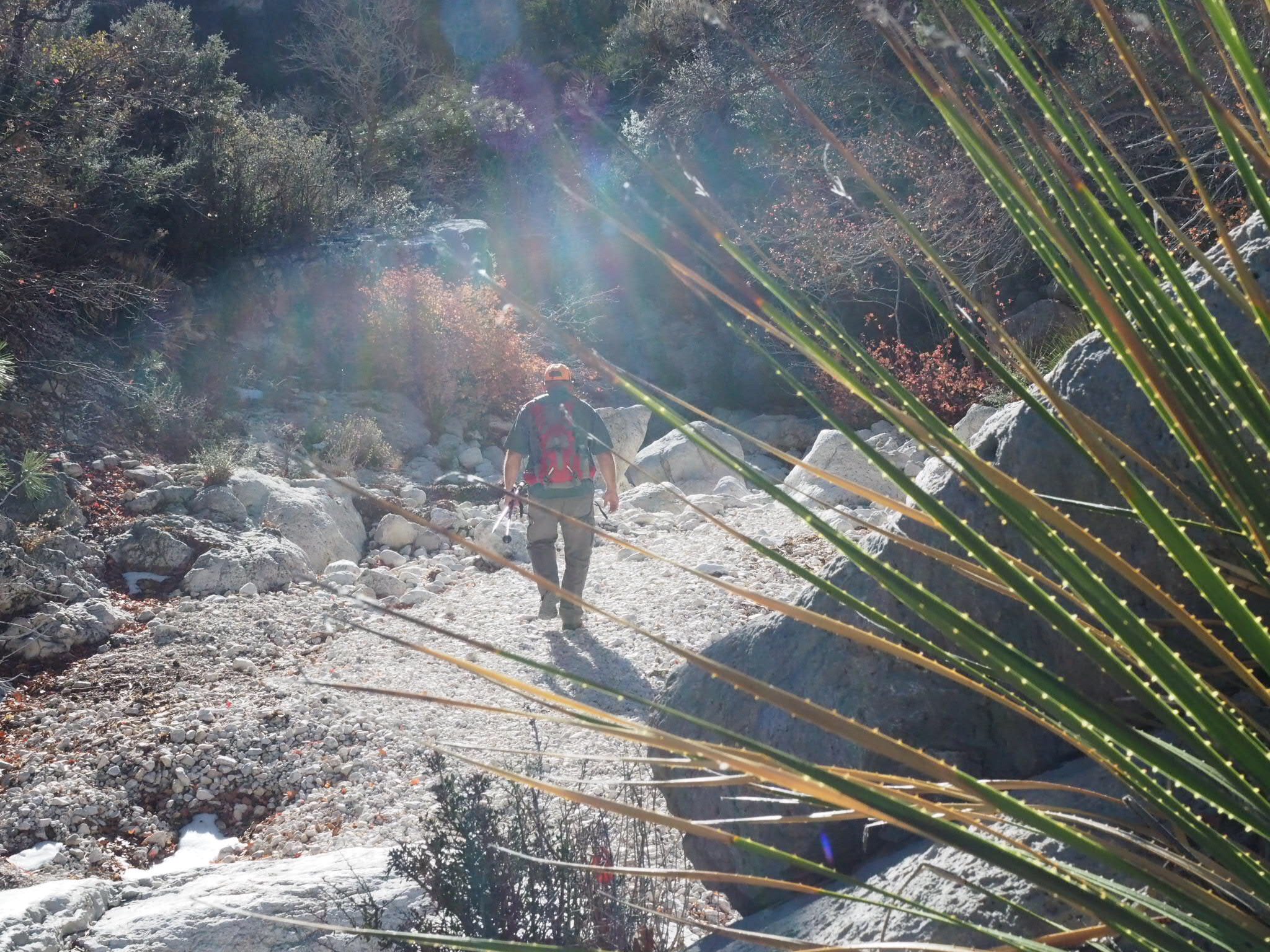
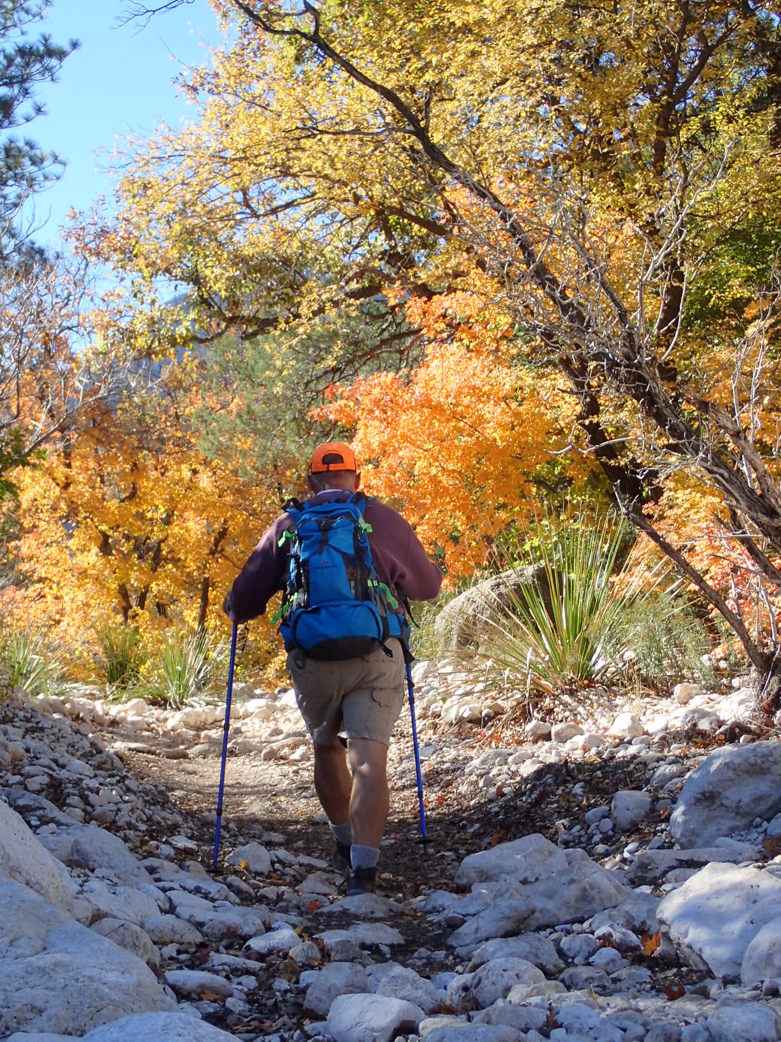
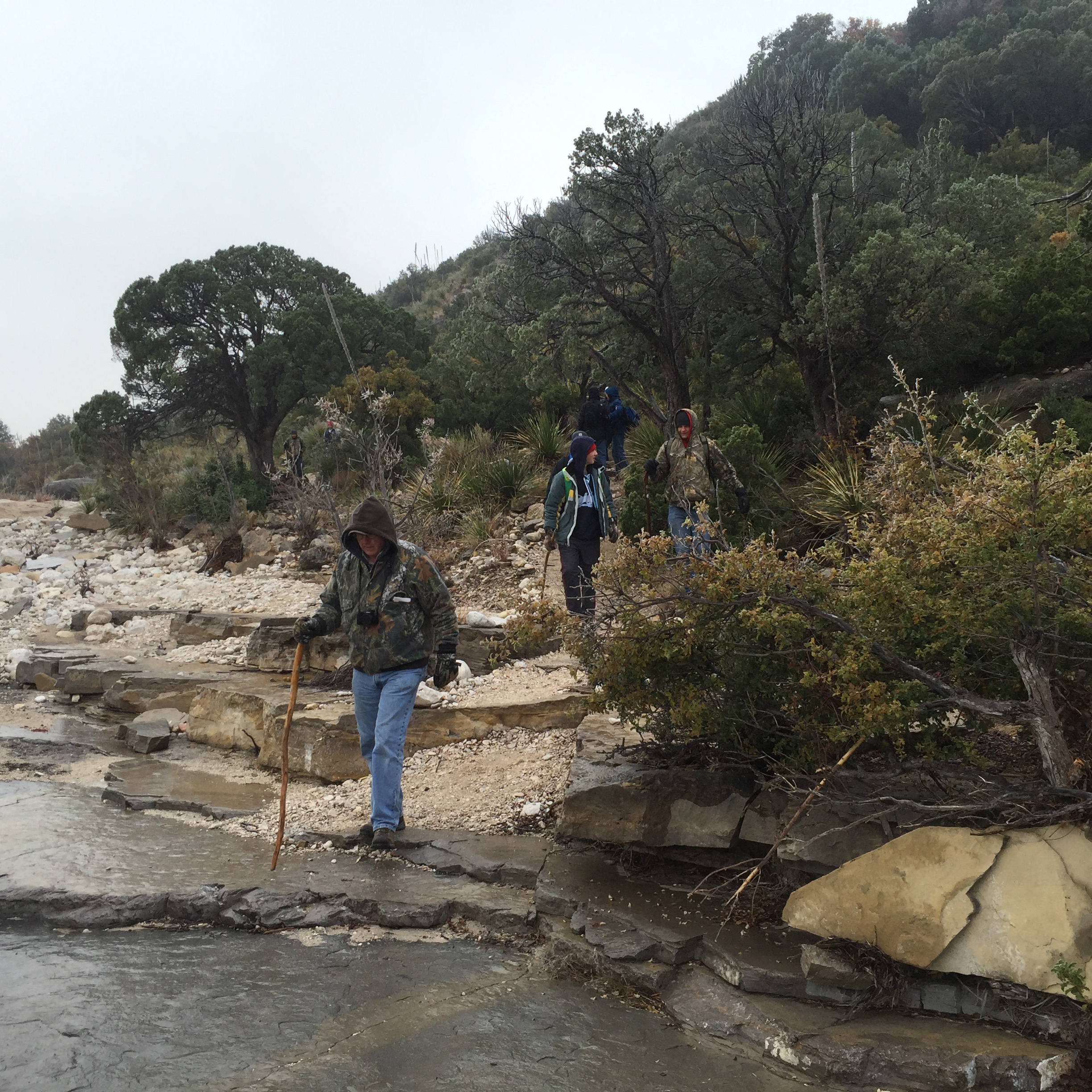
The heat only added to the difficulty. As the morning wore on the temperatures continued to creep higher until they inched past the hundred degree mark. Our bodies craved hydration and electrolytes and power bars.
Every man and boy quickly settled into his respective rhythm as they trudged up the trail, slowly eating away at the elevation. My hiking mantra on this particular trail is pace and place — maintain a steady pace and watch where I place my feet.

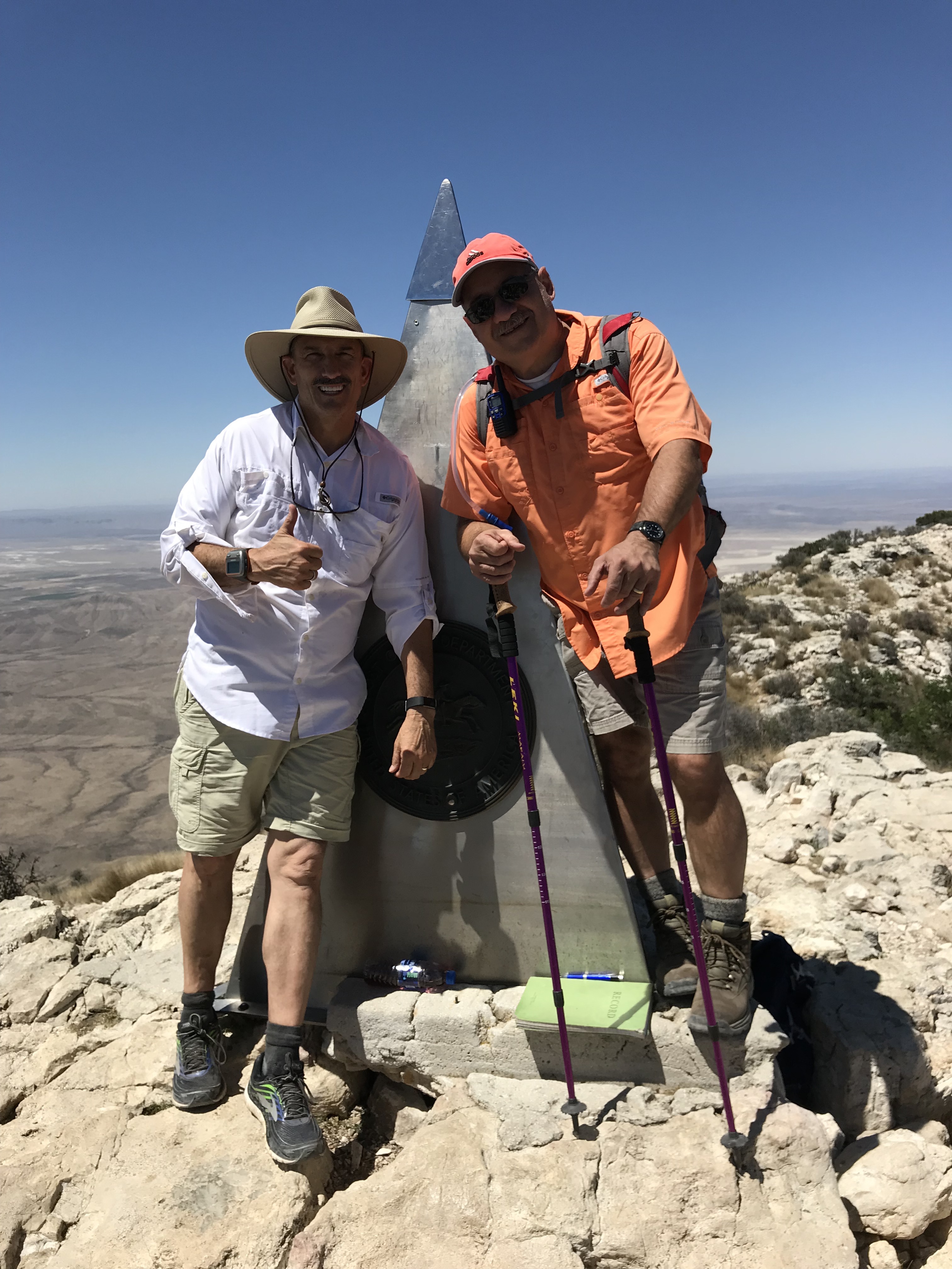
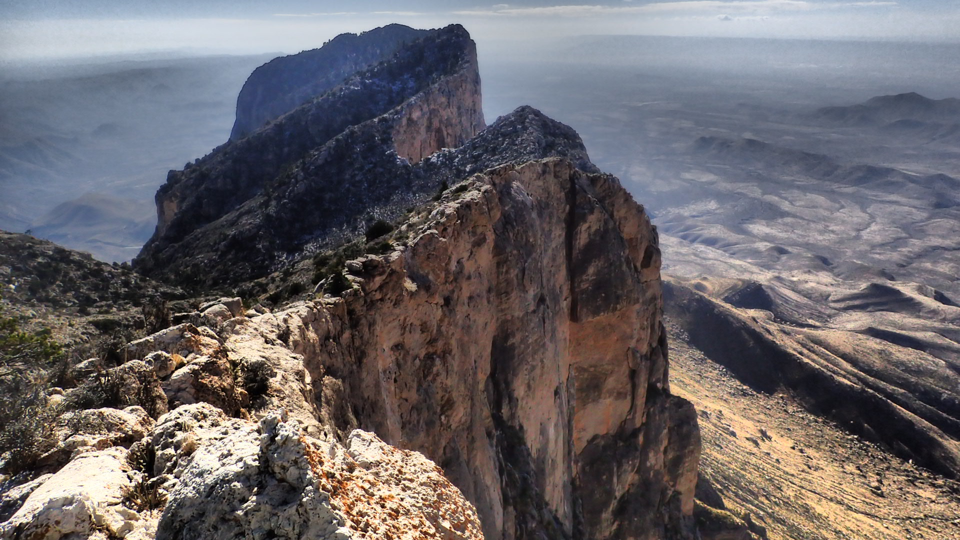
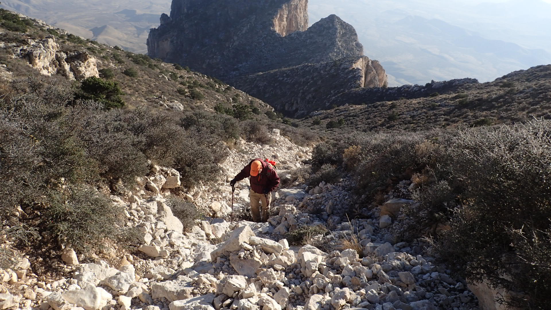
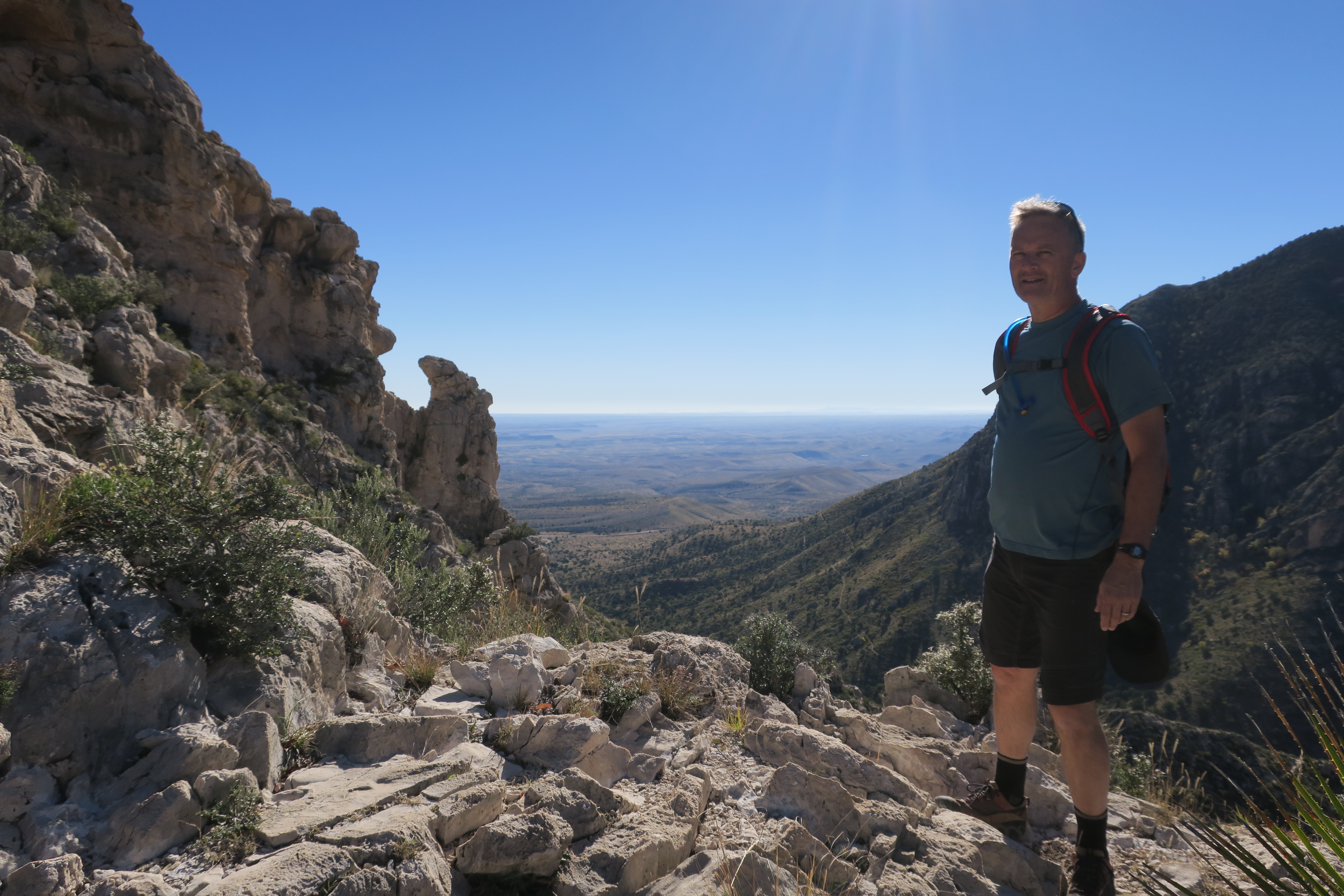
Every one of the guys hiked his own hike and just past mid-morning, we began to populate the summit and feast on the amazing views. I felt just as excited as the day on which I first solo hiked to the top of Texas.
Standing at the summit of Guadalupe Peak with an amazing band of brothers was worth every hard step along the way. This is something we did together — a shared adventure, a reminder that we must do life in community with other men because alone is dangerous.
One thing is certain, the guys on this adventure will always share a special bond. We made it to the top of Texas on one of the hottest days of the year. We watched out for and encouraged one another. We enjoyed great fellowship. And we did it as a band of brothers.

If you are in search of adventure and in good physical condition, consider a trek to the top of Texas. This is one of the coolest bucket-list adventures in the Lone Star State. Although the hike is hard, the reward is worth it. Do your research. Hike prepared. Push past the pain. Enjoy the view.

Salt Basin Dunes

Immediately west of the towering escarpment of the Guadalupe Mountains lies an other-worldly landscape. The Salt Basin Dunes rise modestly above the surrounding salt flats, the remnants of an ancient sea. These dunes of snow-white gypsum are formed by the collaborative artistry of the winds and the white sands of the salt flats.

The process is not entirely complicated. When the winds whip across the salt flats they pick up tiny crystals of gypsum. When these airborne grains slam against the western wall of the Guadalupe Mountains they are deflected upward and then fall back to earth to form the undulating landscape of the Salt Basin Dunes.
From the top of Guadalupe Peak, the highest point in Texas, the salt flats seem strangely out-of-place in the otherwise desert-looking landscape. They have the appearance of snow blanketing the floor of the Chihuahuan Desert. The sight of the salt flats from Guadalupe Peak is quite spectacular and beckons exploring.
The Salt Basin Dunes are a part of Guadalupe Mountains National Park and are accessible by ranch roads not far from Dell City. This day use area offers access to the salt dunes by way of a two-plus mile hike. Because this is a delicate ecosystem, visitors should stay on the trail and not break the fragile cryptobiotic crust beyond the trail. This thin crusty topsoil is essential for preventing erosion, producing soil nitrogen, and stabilizing the soil for vegetation to take hold. So, don’t bust the crust!
The dunes themselves are pretty spectacular. Although this seems to be the most inhospitable of environments, animal tracks in the sand indicate the presence of nocturnal animal activity.  Various desert plants also accentuate the stark white dunes. Yucca, cholla, cactus, and various grasses have staked their claim to life on these shifting dunes.

While the view of the dunes is beautiful from atop Guadalupe Peak, the view of Guadalupe Peak is awe-inspiring from the dunes. You can, in fact, see five of the seven named peaks in Texas that rise over 8,000 feet. From north to south you can see Bush Mountain, Bartlett Peak, Shumard Mountain, Guadalupe Peak, and El Capitan keeping vigil over the dunes.

Regardless of when you visit the Salt Basin Dunes be sure to carry more water than you think you’ll need, a snack or two, and sunscreen in your day-hike bag. Stay on the trail. Have fun exploring the dunes. Take lots of pics. Take a moment to stop and enjoy the silence of the desert. Look toward the east and breathe in the beauty of the Guadalupe Mountains. And, leave no trace but your footprints in the sand.

The Devil’s Hall

John Muir is regarded as one of our nation’s most influential naturalist and conservationist. He inspired the people of his generation to experience and to protect what would later become some of our country’s largest national parks. Muir was no stranger to hiking. His countless miles of meanderings inspired him to write what has become a favorite quote: “Of all the paths you take in life, make sure a few of them are dirt.” That’s really good advice!
Sadly, lots of folks will live a lifetime without ever walking down a dirt path. For those of us who live in the Lone Star State, there is no excuse to not get outdoors to venture down a dirt or rocky path. With over ninety state parks, every Texan is within driving distance of a dirt path. It just takes a little planning and being intentional about venturing out.
Among my favorite day-hike trails is the Devil’s Hall Trail at Guadalupe Mountains National Park. This trail leads hikers to a magnificent narrow canyon called the Devil’s Hall. This four-mile out and back hike is rated moderately difficult because it requires a bit of boulder scrambling. But, don’t let that scare you off. That’s what makes this such a fun trail to hike.

The trail begins at the Pine Springs campground and is well-defined for the first couple of miles. The trail eventually leads to a canyon wash that is filled with scree and boulders. No danger of getting lost, however, as long as you stay in the stream-bed. This wash leads to a stair step series of ledges called the Hiker’s Staircase.

It’s an easy climb up the staircase and past a natural bathtub at the top of this formation. The trail continues a short distance to the Devil’s Hall, a canyon whose walls are lined with horizontal stones that look like they were laid down by a stone mason. This is the turn-around point for this hike.

The Devil’s Hall is especially beautiful in the fall of the year — almost as colorful as nearby McKittrick Canyon, one of the most beautiful places in Texas. The canyon wash is lined with a variety of trees, including big tooth maple, Texas madrone, and ponderosa pine. The trek offers spectacular views of geologic formations and distant mountaintops. In short, this is a really beautiful place waiting to be enjoyed by those willing to take a dirt path.

The Devil’s Hall Trail is a great day hike. Even so, always be sure to take a day pack with snacks and plenty of water. Walk carefully. Enjoy the views. Stop often to breathe and to breathe in the beauty. And be sure to take lots of photos. The Devil’s Hall, and places like it, is a paradise for those who choose to take a dirt path.

Summiting El Capitan

El Capitan, the signature peak of Guadalupe Mountains National Park, rises a modest 8,085 feet above sea level — just enough to make it part of an elite group of Lone Star peaks that are higher than 8,000 feet. I first became acquainted with El Capitan when I traveled to the park in 2014 to solo hike to the summit of Guadalupe Peak, the highest point in Texas.
El Capitan is a ruggedly handsome peak from all angles. And, because of its prominent place, it is likely the most photographed peak in the Guadalupe Mountains. But after seeing this limestone bulwark from the summit of Guadalupe Peak, I was both intimidated and motivated. I knew then that I had to one day bushwhack my way to the top of this mountain.

This past week Doyle Lowry, my hiking buddy, and I met at the national park for a week of cold weather camping and to hike to the summit of El Capitan. Doyle and I had previously made a pact to summit all of the 8,000-foot peaks at the national park. El Capitan would be our fourth peak but far from the easiest since there is no trail to the summit.

We departed our campsite at a little after 7:00 AM and made our way up the Guadalupe Peak Trail. The National Park Service has rated this hike as strenuous because the trail steadily rises 3,000 vertical feet along the way. They are not kidding when they say strenuous. Be prepared to feel the burn in your legs.
Just shy of making the final switchbacks to the top of Guadalupe Peak, we left the trail and started toward El Capitan. Since there is no trail to El Capitan, we selected a prominent landmark and bushwhacked our way to the western edge of the bulwark. This made the hike up Guadalupe Peak Trail seem like a walk in the park (no pun intended). They call it bushwhacking for a reason.

Once we reached the western edge, we picked new landmarks and slowly pushed our way through the brush and scrambled around and over boulders toward the summit. The views from this side of the mountain are beyond spectacular and looking down the sheer cliffs is stomach-churning. Even though our progress was slowed by all of the brush, scree, and boulders, we could tell we were making progress.

We lost and gained elevation several times along the undulated way to the summit. As we neared the summit we also contended with snow on the ground and high winds. Finally, after more than two hours of bushwhacking, the summit came into view — and it was indeed beyond spectacular. We stood at the pinnacle of this intimidating peak and breathed in the most amazing views.
Before making our way back down, Doyle located the ammo box containing the summit log and we both signed our names in the book. There were very few names in the book, and understandably so. If you want to stand on the peak of El Capitan you have to be a little crazy and a whole lot determined. As Doyle pointed out, what we both lacked in youth and endurance we made up for in grit and determination.

After enjoying a few minutes on the summit, we started bushwhacking our way back toward the Guadalupe Peak Trail. This time we opted to do the final push along a dry ravine filled with boulders and scree — either that or battle the thick brush again. But, hard as it was, we finally reconnected with the Guadalupe Peak Trail.
Once we reached the trail, we decided to make our way to the summit of Guadalupe Peak — a third summit for each of us. From there we looked northward toward Shumard Peak and Bartlett Peak, two more of the 8,000+ foot peaks that we hope to summit next year. We started our descent by 4:30 PM. What had previously taken us far less than two hours to hike took us two and a half hours because we had to hike in the dark and had to hike slow because of the snow and ice on the trail.
Finally, after 11 hours and 43 minutes on the trail, we reached the Pine Springs campground and entered our time into the hiker’s registry. We are beyond elated at our accomplishment. Not a bad day for two old guys who hear the clock ticking and want to get in as many adventures as possible while it is still possible. For me, bushwhacking to El Capitan is officially the hardest day hike I have ever done — and the most rewarding. And hiking with a good friend who loves the outdoors is always a bonus! Already looking forward to our next adventure at Guadalupe Mountains National Park.

Return to McKittrick Canyon

After my first visit to McKittrick Canyon I knew without question that I had to return. The mesmerizing beauty of this rugged landscape sliced into the eastern edge of the Guadalupe Mountains had earned a place in my memory. And not just any place but instead a place near the front where it refused to be ignored.
McKittrick SignMy travel schedule did not allow me to return in the spring as I had hoped. I determined, therefore, to return in the fall when the canyon bursts into a palette of colors that have earned it the reputation as the most beautiful spot in the Lone Star State. Once you visit you will understand why its hard to argue against that. It is indeed a beautiful and unforgettable place.
mckittrick-trail-wide-copyWhether you are a seasoned hiker or a novice, McKittrick offers trails to scratch every itch. The McKittrick Trail, a round-trip of about eight miles, is family friendly. The trail is flanked by beautiful trees and native plants hemmed in by jagged canyon walls. The color of the big-tooth maples is accented against the varying shades of green of alligator junipers and manzanita trees with their tiny apple-like berries.
mckittrick-manzanita-treeThe Grotto, a small limestone cave that resembles the gaping toothy mouth of a dragon is the perfect spot for a picnic. The park service has built some rustic tables at this location under the shade of the trees. You can turn around at this point or head just a little farther up the trail to the Hunter’s Line Shack, built in 1924 — worth the extra steps.
doyle-at-mckittrickFor those with more adventurous ambitions, you won’t be disappointed. There are even more hiking options available. But, regardless of whether you do a short or long hike, be sure to take a hydration pack and some snacks. Sign in at the trailhead when you start your hike and sign out when you leave. This will help the park personnel account for all visitors.
mckittrick-tumor-treeRegardless of where you live in the Lone Star State, make it a point to add McKittrick Canyon to your list of outdoor adventures. Consider visiting in the fall when the colors in the canyon are at their peak. Visiting and taking even a short-hike at McKittrick will do you good. In the words of John Muir, “In every walk with nature one receives far more than he seeks.” You will certainly find that to be true at McKittrick Canyon.
Omar Hike McKittrick

Summiting Hunter Peak

Six of the seven named peaks in Texas that are more than 8,000-feet in elevation are located in Guadalupe Mountains National Park. Of these six, three are accessible by steep and rocky trails — Guadalupe Peak, Bush Mountain, and Hunter Peak. The others can only be reached by those intrepid enough to bushwhack their way across rugged terrain with topo map and compass in hand.
Guadalupe Mountains PanoramicOn my recent visit to Guadalupe Mountains National Park, my friend Doyle Lowry and I decided to start our quest to summit all seven peaks by hiking to the top of the peaks accessible by trail. Now, just because these peaks are accessible by trail does not necessarily make them an easy win. Quite the contrary!
bush-mountain-and-hunter-peakAfter reaching the top of Guadalupe Peak, we set our sights on summiting Hunter Peak. The Hunter Peak trailhead is accessible by way of the long and switch-backing Tejas Trail. The Hunter Peak trail itself is rated as difficult but is a beautiful hike.
Doyle on Tejas TrailDoyle and I set off from our base camp at Pine Springs Campground as soon as the sun came up. We followed the winding Tejas Trail toward the junction of the trailhead to Bush Mountain and Hunter Peak. The Tejas Trail slowly winds its way up the mountain and features long inclines and gentle switchbacks that lead to ever-increasing elevations.
Omar on Tejas TrailAfter several miles of hiking we reached the trailhead that leads to Bush Mountain to the west and Hunter Peak to the east. We took a ten-minute nutrition break at the trail junction and then set off on the Bowl Trail until we reached the intersection of the trail that leads to Hunter Peak. This was by far one of our very favorite hikes. The area is absolutely beautiful. But, like the other trails leading to the summits, the trail led increasingly upwards.
Omar and Doyle Hunter PeakFinally, Hunter Peak came into view. When we reached the summit we were rewarded with much more than we expected. The views from Hunter Peak have to be the most beautiful in the park. Absolutely magnificent views in every direction. From the summit we could see all of the other peaks in the park as well as hundreds of miles toward the distant horizons.
Omar Pointing at Hunter PeakWe started our descent a little after mid-afternoon and slowly made our way back to base camp, stopping along the way to take more photos. We reached the lower portions of Tejas Trail as the sun disappeared over the peaks and finished our hike in the dark.
Basecamp at NightGuadalupe Peak gets lots of attention at the park and understandably so. After all, it is the highest point in Texas. However, the views from Hunter Peak rival if not exceed those from Guadalupe Peak (at least in our estimation). So, if you set your sights on Guadalupe Peak, make it a point to spend an extra day and hike up to Hunter Peak. I promise that you will not be disappointed.

McKittrick Canyon

The most beautiful spot in Texas. These are the words that piqued my interest in McKittrick Canyon. Located near the eastern edge of the Guadalupe Mountains National Park, the canyon has the most breathtaking display of fall colors in the Lone Star State. These spectacular fall colors attract thousands of visitors to the park in late October and early November.
Cold Guadalupe PlantsAlthough I visited the canyon in late November, I was not disappointed. Friends and I camped at the Pine Springs Campground under overcast skies and freezing rain. The morning of our planned hike to McKittrick greeted us with 20-something degree temperatures and a world of ice. Through the night, the freezing rain had turned the plants and trees in the park into beautiful ice sculptures. We all felt privileged to see the park as few others have the opportunity to see it.
McKittrick SignMcKittrick Canyon is located about seven miles from the Pine Springs Visitor Center — the headquarters for Guadalupe Mountains National Park. We paid our entrance fee at the visitor center and then drove to the canyon. The freezing temperatures kept most sane folks away so we had the canyon pretty much to ourselves. Once we arrived, we wasted no time in setting off down McKittrick Trail toward the Grotto and the Hunter Line Shack (a round-trip hike of about eight miles).
McKittrick Trail ColorMcKittrick Canyon has a beauty all its own. It did not take long for us to realize that we were indeed in one of the most beautiful spots in the Lone Star State. We hiked through a striking palette of fall colors made even more dramatic by the cold, overcast skies. Colorful big-tooth maples, deep-green alligator juniper, bark-shedding manzanita trees, and other native plants each contributed to the beauty of the canyon.
McKittrick Hike RandyThe McKittrick Trail is the most popular in the park and a relatively easy trail to hike. The path is well-maintained and marked, making it almost impossible to get lost. The trail also crosses the only year-round stream found in the park. This stream is home to Texas’ only reproducing stock of rainbow trout. We hiked this trail to the Grotto, a tiny limestone cave filled with stalagmites and stalactites.
McKittrick Grotto GroupJust past the Grotto is a beautiful picnic area with rock tables and benches. We lingered a while at this peaceful spot and just soaked in the beauty of the place. After enjoying a few snacks, we wandered down the trail to the Hunter Line Shack, built in 1924. You can’t visit a place like this without letting your imagination run wild — wondering about the people who built and used it. What an amazing setting for a cabin! The stars at night must have indeed seemed big and bright to the guys who built this cabin deep in the heart of the canyon.
McKittrick Hunter CabinMcKittrick Canyon is just one of the gems that makes a trip to the Guadalupe Mountains National Park worth the drive from anywhere in Texas. In addition to this amazing place that boasts the best fall colors in the state, the park is also home to Guadalupe Peak, the highest point in Texas, and El Capitan, the most dramatic landmark in the Lone Star State. I’m glad my friends and I visited the canyon in the fall. I look forward to returning again soon to enjoy the beauty of the canyon in the Spring or Summer.
McKittrick Hike w Jonathan