The Highland Lakes are a chain of seven lakes that were formed when the Lower Colorado River Authority built a series of dams along the Colorado River. Unquestionably one of the most beautiful regions in the Lone Star State, the Highland Lakes offer lots of enjoyable recreational opportunities for anyone looking for an affordable Texas adventure.
 Lake Buchanan, the second largest of the Highlands Lakes in Central Texas, is the starting point for the Vanishing Texas River Cruise. This cruise was the brainchild of a man named Ed Low. In 1981, Ed envisioned starting a cruise to acquaint folks with the ecological beauty of the Highland Lakes region. The Vanishing Texas River Cruise introduces visitors to some really spectacular views of Lake Buchanan and the Colorado River — vistas that are best enjoyed from the water.
 Since its start in 1982, the Vanishing Texas River Cruise has become the premier ecological tour in the Lone Star State. The relaxing two-hour cruise is hosted by a knowledgeable guide who points out native wildlife, waterfalls, and varieties of birds — including wintering Bald Eagles. The cruise also navigates over the ruins of Blufton, an entire town that was submerged in 1937 when Buchanan Dam was completed and filled. The old town ruins are visible only in seasons of drought.
 The Vanishing Texas River Cruise folks offer a variety of cruises aboard their 120-passenger Texas Eagle II boat. The lower level features an air-conditioned cabin with large picture windows that make it easy to view the scenery. The upper open-air deck is covered and also gives passengers complete visual access to the passing scenery. You can bring a sack lunch or purchase one of the box lunches as a part of your package.
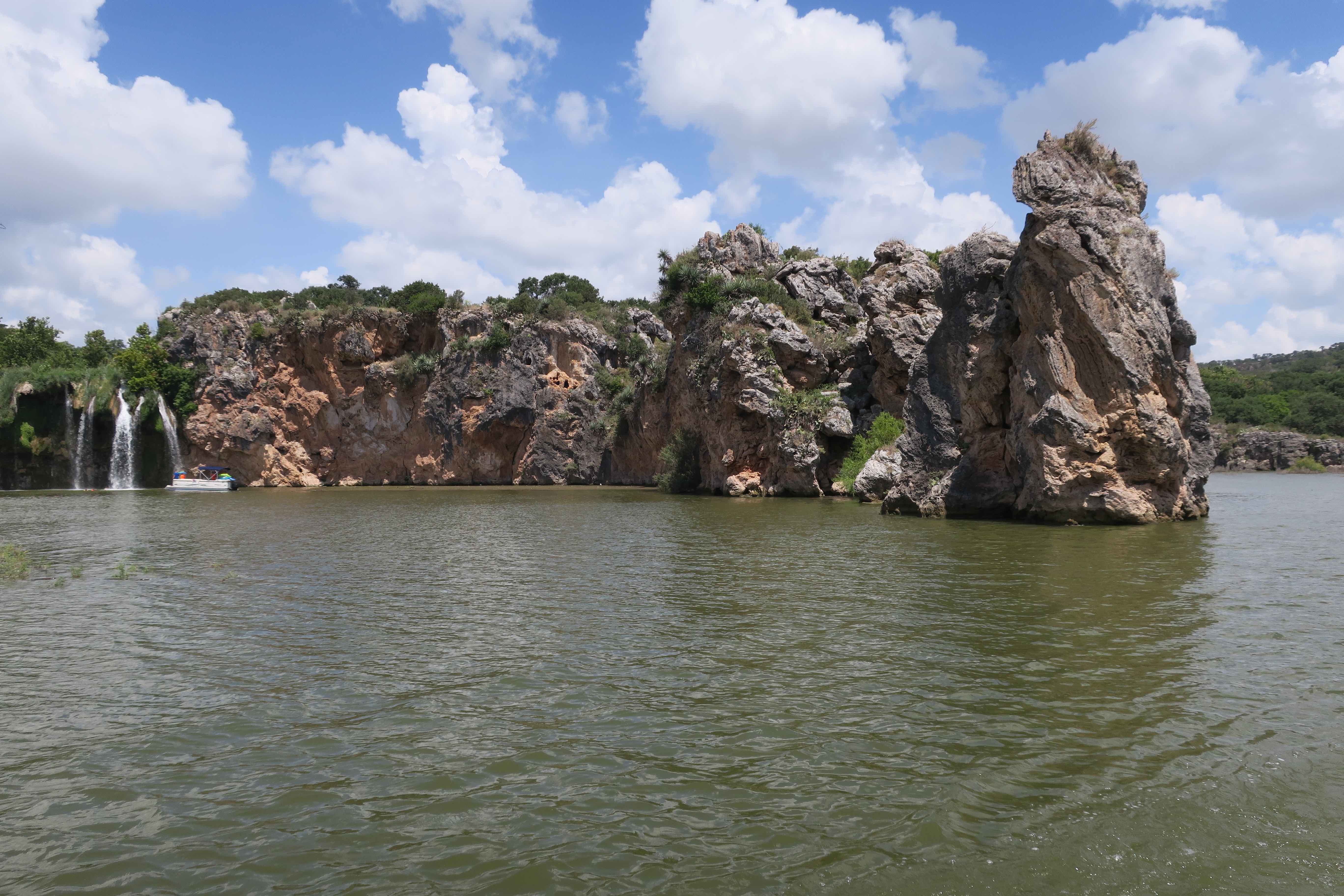 I can’t say enough about the staff. As someone who has toured all over the world and listened to tour guides in more than three-dozen countries, the guides on the Vanishing Texas River Cruise are among the very best. These guys know their stuff, communicate in an engaging way, and are always ready to answer questions. I learned a lot in the two-hours I spent aboard the Texas Eagle II.
 Regardless of where you live in Texas, it is worth the drive to the centrally located Vanishing Texas River Cruise. Visit their website to learn more about their various cruises and how to reserve your space before heading their way. If you have never visited the Highland Lakes, then I encourage you to do so. And be sure to make the time for a Vanishing Texas River Cruise to see Texas in a whole new way.
Road Trips
Digging for Topaz
Topaz is the official gemstone of Texas as well as the birthstone for the month of November. This beautiful gemstone is found only among the granite hills and sandy creek beds of Mason County — in the geologic region of the state known as the Llano Uplift. The town of Mason, the county seat, is about an hour’s drive from Fredericksburg in the beautiful Texas Hill Country.
 Topaz was found in greater abundance in Mason County at the turn of the twentieth century. Old-timers speak of stumbling across topaz stones while looking for arrowheads in creek beds. In those days, however, there was a greater demand for arrowheads. Topaz was just another pretty rock.
 Today, topaz hunters have to look a little harder and dig a little deeper to find this stone. Topaz resembles shards of broken glass or frozen water, thus earning it the nickname “Desert Ice.” Topaz, however, also occurs naturally in a variety of colors including blue, orange, brown, green, beige, and red. A good place to look for topaz is around granite outcroppings in creek beds and ditches.
 Digging for topaz has been on my wife Cheryl’s list of Texas adventures for quite some time. So, we finally made the time to head to Mason County to try our hand at searching for the Texas State Gem. We set out with the understanding that topaz is hard to find and that we would be content to just share this adventure together.
 Cheryl arranged for us to dig at the Seaquist Ranch in Mason County. The Seaquist family left their native Sweden at the turn of the twentieth century and settled in Mason County. The family still owns and operates their ranch located a few miles outside of the town of Mason. People have enjoyed rock hunting on the Seaquist Ranch since the 1970’s.
 Our adventure began at eight in the morning. We met Jean Seaquist in the parking lot of the Dairy Queen in Mason, paid our $20 per person fee, and set off for the ranch. Jean personally escorted us to an area of the ranch known as Topaz Gulch — a creek bed snaking its way through the rugged hills at the base of pink granite outcroppings.
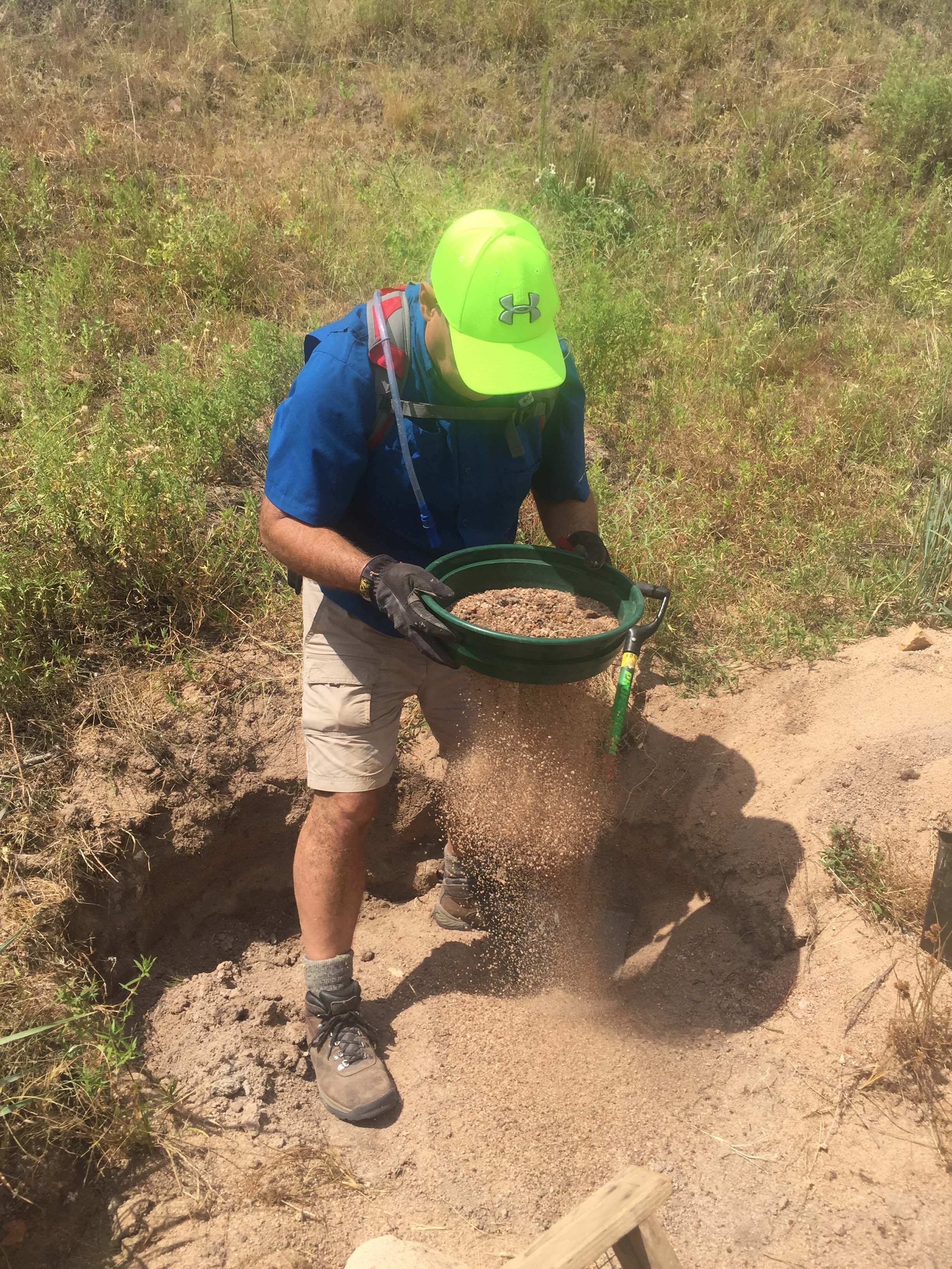
 After our orientation, we set up our base camp — our canopy, camp chairs, and ice chest filled with fruit, water, and gatorade to beat the heat. And then we collected our gear and set off for the creek bed. We worked an hour at a time, digging and sifting material in our soil sifters. We found lots of pretty rocks and some that might be topaz. We’ll know more when we’ve had time to clean and examine our haul.

All in all, this was a fun and affordable adventure. Like fishing, you have to be prepared to just enjoy the experience regardless of whether you catch anything. The best part of the adventure was the anticipation of finding something and spending lots of quality time together. We both agreed that we’d like to share this adventure again in the future. And that is priceless!
Iwo Jima Monument in Harlingen
On February 23, 1945, Associated Press photographer Joe Rosenthal captured a unique moment in time at the Battle of Iwo Jima. Rosenthal’s photograph of the Marines of Company E, 2nd Battalion raising the American flag atop Mount Suribachi endures as one of the greatest war photographs in U.S. history. His image resonated with the American people and became an iconic representation of the fierce resolve of the greatest generation to fight for the preservation of our democratic way of life.
 Rosenthal’s photograph stirred the heart of a sculptor named Dr. Felix W. de Weldon. On duty with the U.S. Navy at the time Rosenthal’s photograph was released, Dr. de Weldon immediately constructed a small scale model of the scene. After the war, he worked for nine and a half years to depict the scene on a more massive scale. Once Dr. de Weldon completed the plaster model, he spent an additional three years overseeing the bronze casting process.
After the massive sculpture was completed, the various parts were shipped to our nation’s capital and assembled at Arlington National Cemetery. President Dwight D. Eisenhower officially dedicated Dr. de Weldon’s bronze memorial on November 10, 1954 — the 179th anniversary of the U.S. Marine Corp.
 The working model of the memorial was stored at Dr. de Weldon’s summer home and studio in Newport, Rhode island. In October 1981, Dr. de Weldon gave this full-sized working model to Marine Military Academy in Harlingen, Texas. Dr. de Weldon felt that the climate at this South Texas location was ideal for the preservation of the molding-plaster figures.
The fact that Corporal Harlon H. Block, the Marine placing the flagpole into the ground, was a native of the nearby town of Weslaco also influenced Dr. de Weldon’s decision about where his sculpture should permanently reside. Block was killed at Iwo Jima just six days after the flag raising. His gravesite is located behind the monument.
 The massive sculpture, dedicated April 16, 1982, is situated on the Marine Military Academy Parade Ground. When my wife and I drove to Harlingen to visit the Iwo Jima Monument and turned onto Iwo Jima Boulevard, our first sight of the monument caught us completely off guard. Our jaws dropped at the inspiring sight of this moment in time captured by a war photographer and sculpted by a Navy veteran.
 Dr. de Weldon hoped that his gift would serve as an inspiration to the young cadets at Harlingen’s Marine Military Academy. There is no doubt that it has done just that. But his gift also serves as an inspiration to the many visitors who travel to Harlingen from all over the country to see this magnificent memorial to a time when uncommon valor was a common virtue.
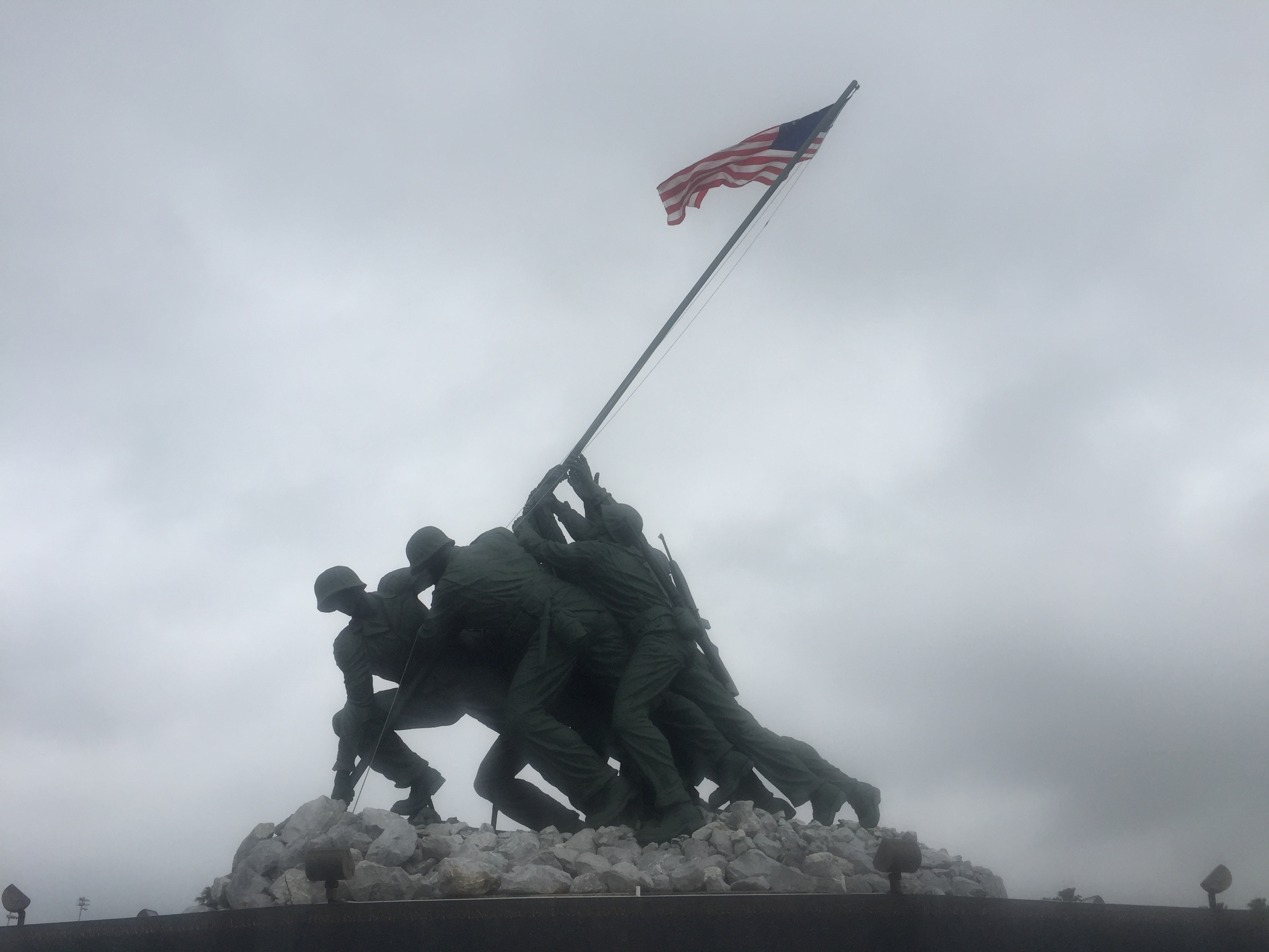 If your travels take you anywhere near South Texas, make it a point to drive whatever extra miles you need to in order to visit the Iwo Jima Memorial and Museum at Marine Military Academy in Harlingen. Those of us who enjoy the blessings of living in the United States of America certainly owe a debt of gratitude to the men and women of the greatest generation for their courage and sacrifices. I am thankful for Joe Rosenthal and Dr. Felix W. de Weldon for their gift to the American people.
Road-Tripping Close to Home
One of the advantages to living anywhere in the Lone Star State is having quick access to off-the-beaten-path drives. The Lone Star State’s network of Farm to Market roads can connect travelers with some of the most scenic places in the state. I enjoy wandering down these backroads where I can soak in the richness of Texas.
 Here is a sample of one of my no-agenda backroads excursions. The starting point was my home in beautiful Katy just west of Houston. I have convenient access to Interstate 10 and from there to Farm to Market roads and even more remote unpaved roads that lead me deeper into the heart of Texas.
 My first stop was at the San Felipe de Austin State Historic Site. Founded in 1823 by Stephen F. Austin, the Father of Texas, this little colony was the focal point for issues related to the immigration and settlement of American colonists in Mexican-controlled Texas until 1836. Austin built his only home in Texas at San Felipe de Austin. His log cabin also served as the colony’s land office and became the center of San Felipe commerce.
 From San Felipe I headed farther west on my backroads excursion. I enjoy the backroads because there is little traffic and I can drive slowly in order to better appreciate the sights. While driving, I received a Weather Channel message on my phone alerting me to severe thunderstorms in the area. I could see the approaching storm in the distance. The darkening skies created some beautiful light, making all of the sights a little more dramatic.
 I especially enjoyed seeing the old houses and farm buildings, places no longer inhabited that are slowly losing the battle against time and the elements. Looking at these old houses always makes me wonder about who might have lived there or who looked forward to returning there to visit family or friends on holidays and ordinary days. These old decaying homesteads always remind me that we are here for a season and should therefore make the most of every day that we have.
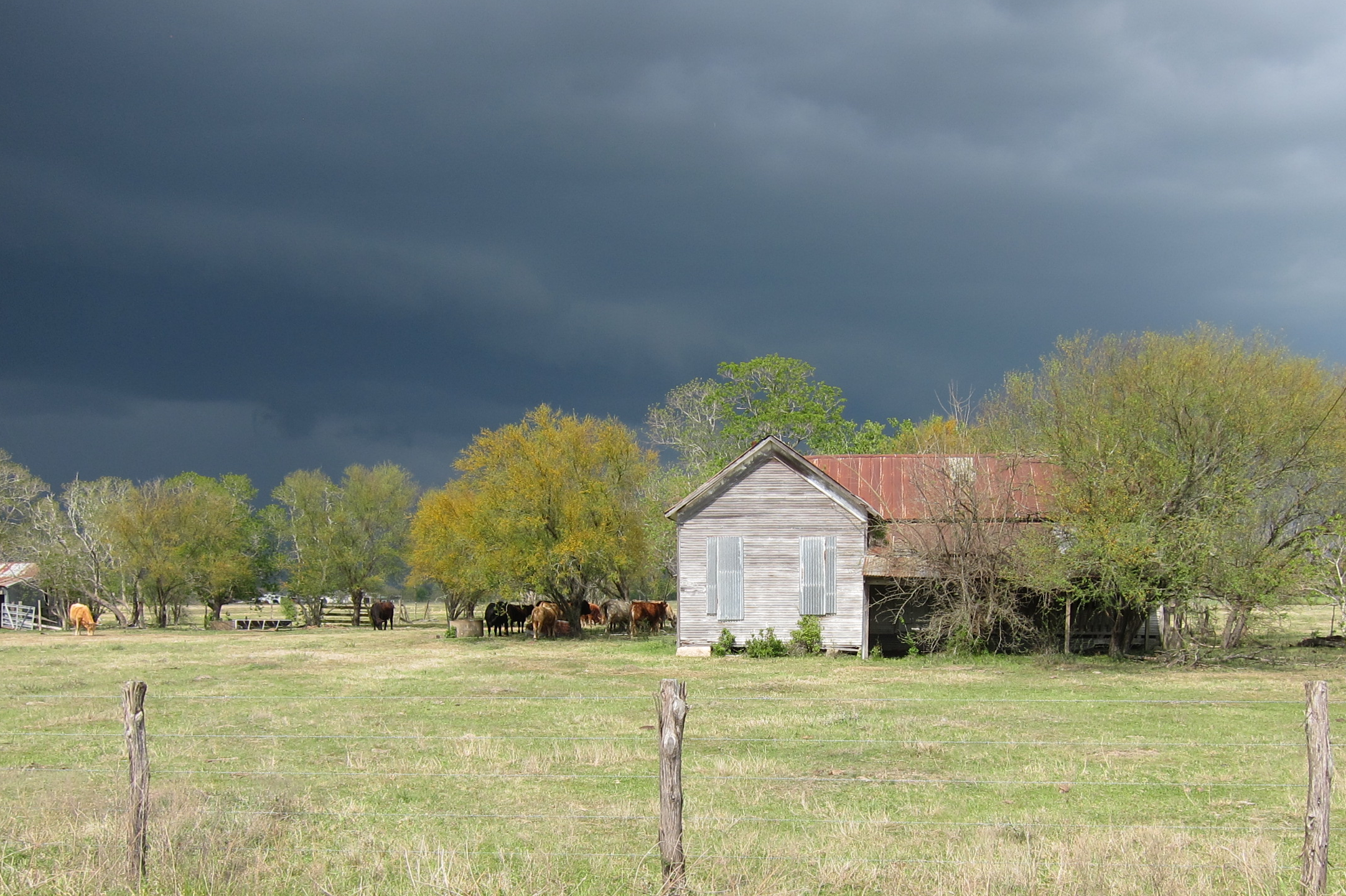 After a couple of hours of driving, the thunderstorms finally arrived. There is nothing quite like the smell and sound of rain in the Springtime — absolutely therapeutic. My drive home was slower because of the heavy rains, but I absolutely enjoyed every mile. Although I only spent a few short hours away from home, I was refreshed by the experience.
 You don’t have to travel far to have an adventure, but you do have to venture out and away from where you are. Little backroads excursions do not cost much and they do yield good returns. I encourage you to find your next adventure on a Farm to Market or gravel road close to your home. It’s a great way to redeem an afternoon and to learn a little more about the people and places that have shaped the history of your area.
5 Facts About Texas Bluebonnets
I love Springtime in Texas — that wonderful season when highways and byways in the Lone Star State are adorned with the most beautiful wildflowers. While you may not know the names of all of these colorful spring blooms, any self-respecting Texan can recognize the bluebonnet in the bunch.
The bluebonnet is “not only the state flower,” wrote historian Jack Maguire, “but also a kind of floral trademark almost as well known to outsiders as cowboy boots and the Stetson hat.” Maguire also said: “The bluebonnet is to Texas what the shamrock is to Ireland, the cherry blossom to Japan, the lily to France, the rose to England and the tulip to Holland.”
In anticipation of wildflower season in Texas, I thought it might be fun to consider five interesting facts about Texas bluebonnets.
1. The bluebonnet is the official state flower of Texas.
If you are from Texas, this is one fact that we all learned in elementary school. However, things could have been different when the Texas Legislature was considering our state’s official mascots in 1901. The bluebonnet was, in fact, one of three blooms under consideration by our elected officials at the time.
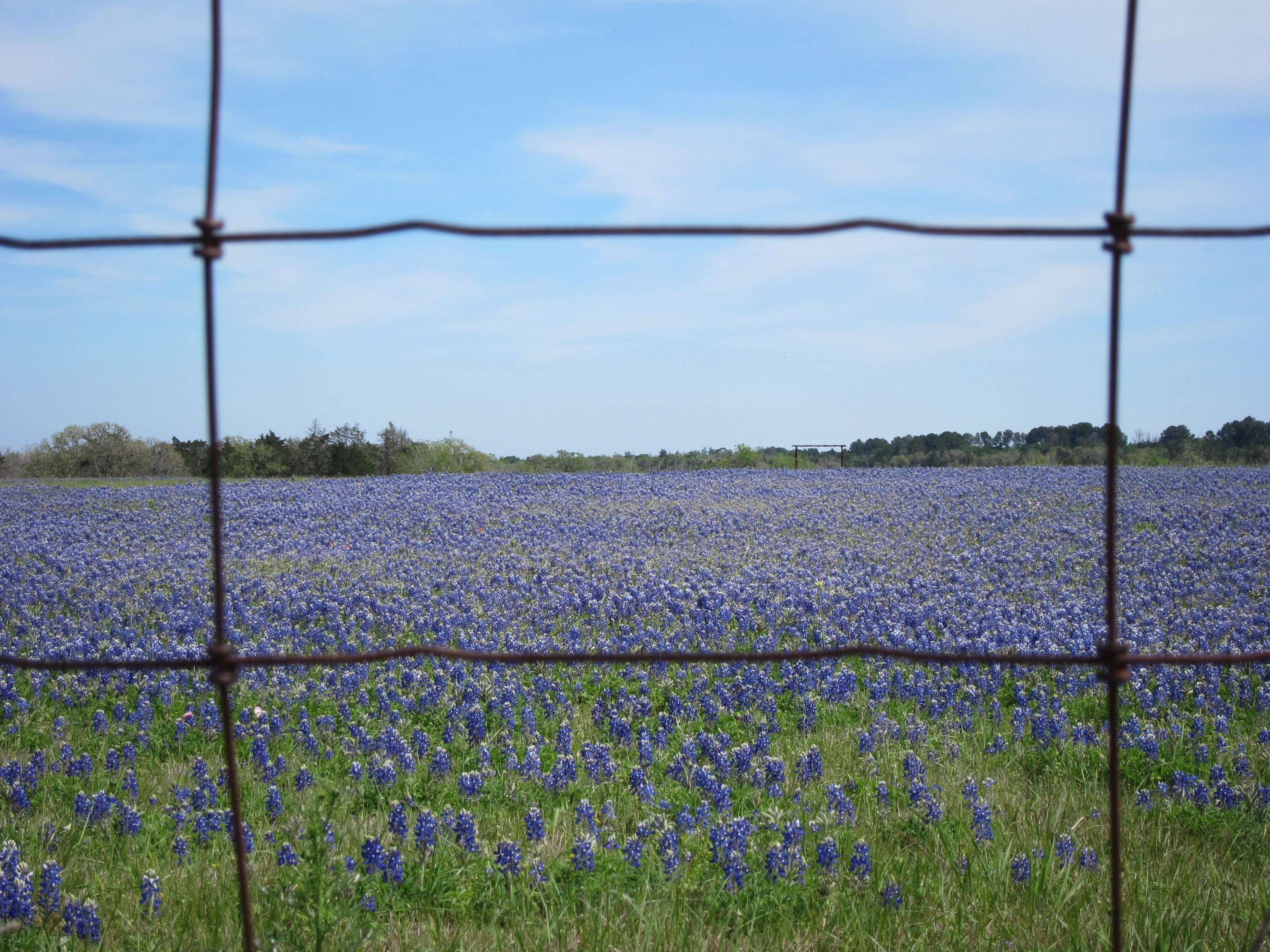 The cotton ball was nominated but did not garner much support because, quite frankly, it’s somewhat plain and not much to look at. A fellow named “Cactus Jack” Garner, reputed to be as prickly as his name, nominated the pretty flower of the prickly pear cactus. This hardy flower also lost out. These nominees paled by comparison to the bluebonnet, nominated by the National Society of Colonial Dames of America.
2. A bluebonnet by any other name.
The bluebonnet is also known by other names, including Buffalo Clover and Wolf Flower. The Spanish called the bluebonnet El Conejo from the Spanish word for rabbit because the bluebonnet’s white tip looks like a cottontail rabbit’s tail. The bluebonnet was also called Azulejo from azul, the Spanish word for blue. According to the Lady Bird Johnson Wildflower Center, this word can be loosely translated as “indigo bunting.”
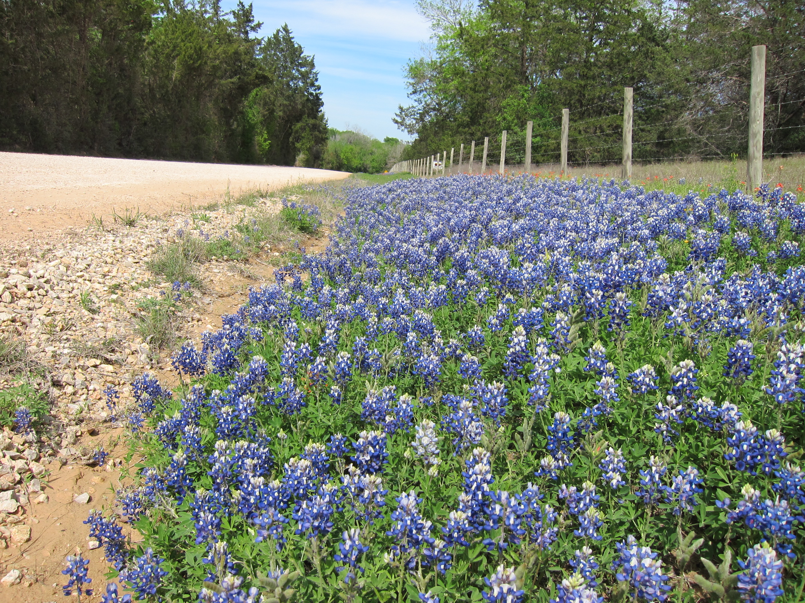 Texas is home to five native species of bluebonnets. In 1901, the Legislature selected lupinus subcarnosus as the state flower. However, citizens protested and petitioned that the lupinus texensis was a better choice because of its larger and more vibrant blooms. The matter was finally settled in 1971 when the Legislature classified all five species of bluebonnets as the Texas state flower.
3. Texas was the first state to plant flowers along state highways.
When the Texas Department of Transportation was organized in 1917, officials noticed that wildflowers were among the first plants to appear along roadways in the Springtime. In 1932, the department hired a fellow named Jac Gubbels as its first landscape architect. Gubbels was charged with maintaining, preserving, and encouraging the growth of wildflowers and other native plants along Texas roadways.
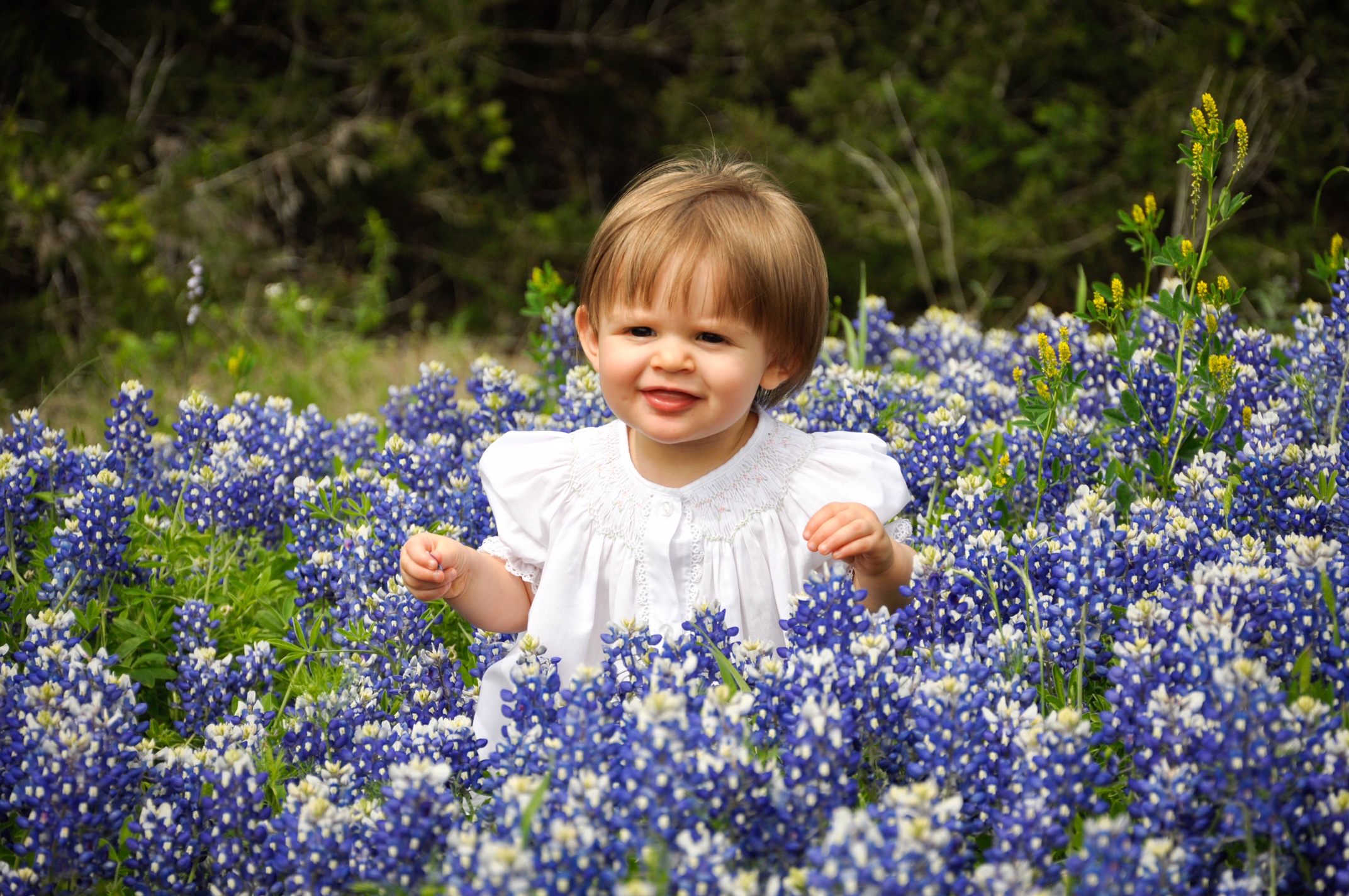 In 1934, the department started to delay mowing along Texas roadways until the end of wildflower season. Today, the Texas Department of Transportation buys and sows about 30,000 pounds of wildflower seeds each year, making Texas highways among the most beautiful and scenic in the nation. Every year, flower lovers from around the state and around the nation can be found taking photos among the bluebonnets along Texas roadways.
4. And the award goes to…
The 1997 Texas Legislature named Ennis the official Bluebonnet City of Texas. And because Ennis is home to forty miles of roadsides covered with wildflowers, the Legislature also recognized Ennis as the Texas Bluebonnet Trail. Ennis holds its annual Ennis Bluebonnet Trails Festival every April.
 The town of Chappell Hill calls itself “the heart of Bluebonnet Country” and earned the title “Official State of Texas Bluebonnet Festival.” Chappell Hill holds its annual Bluebonnet Festival in April. And then there is Burnet, recognized by the Texas Legislature as the “Bluebonnet Capital of Texas.” Burnet holds its own Bluebonnet Festival during the second week of April.
5. Different species of bluebonnets bloom in the Spring.
Unless you are a naturalist, you will likely not be able to tell much difference among the various native species of bluebonnets. That’s ok! The important thing is to enjoy the bluebonnets that grow in or near your particular region. Here is a quick guide on where to go and what to look for.
Lupinus Texensis are found in Central Texas from late March to early April. Look for pointed leaflets and blue flowers tipped with white.
Lupinus Subcarnosus grow in Hidalgo, Leon, and LaSalle counties. Look for blunt leaflets and widely spaced flowers in late March.
Lupinus Havardii grow in Big bend country and grow up to three feet tall in early spring.
Lupinus Concinnus grow in the Trans-Pecos region in the early spring. These bluebonnets only grow as high as seven inches and produce flowers in purple, lavender and white.
And, finally, Lupinus Plattensis can be seen throughout the Panhandle plains from mid to late spring. These particular plants grow as tall as two feet.

Texas Outdoor Musical
If you live in Texas, you should add Palo Duro Canyon State Park to your list of must-see places in the Lone Star State — not only to enjoy the magnificent beauty of the canyon, but to see the outdoor musical drama “Texas.” This musical romance of Panhandle history will fill you with Texas pride. Now in its 51st season, “Texas” is even better than I remember when I first saw it in its 5th season.
 This musical drama, set in an outdoor amphitheater dwarfed by the thousand-foot walls of Palo Duro Canyon, was born in the heart of Margaret Harper. After reading an article in Reader’s Digest about a playwright named Paul Green who specialized in telling the history of a region in magnificent outdoor settings, Harper wrote to Green about the beauty of the Palo Duro Canyon. The rest is history.
The musical is a high-energy production filled with all of the things that make a story interesting, including conflict and romance. From the start, you are drawn into the story by a lone rider carrying a huge Texas flag, riding at full gallop along the edge of the canyon. And then it begins, the dancing and singing and the unfolding story of how the Panhandle was settled. One interesting side-note is that Benny Tahmahkera, the actor who plays Quanah Parker, the last Chief of the Comanches, is an actual descendent of Quanah Parker.
When my wife Cheryl and I sat through a performance last summer, at one point the wind picked up and we could smell the coming of rain. It’s happened before in this outdoor setting. As the nervous audience looked at the stage and at the dark clouds overhead, the actors on stage were lamenting a West Texas drought that threatened their crops. And then, the first drops of actual rain fell from the sky at the exact moment that Calvin Armstrong, a young homesteader, received word that it was raining and the drought was over. You can’t plan stuff like that!
 There is so much more to tell about this beautiful story. So, plan now to see it this year. The new season starts in June and ends in mid-August with performances every day of the week except Mondays. Visit the Texas Show website to book your tickets. And, take a few extra bucks with you and enjoy a heaping plate of grub at the Chuck Wagon Bar-B-Que. Regardless of whether you are from Texas, you’ll enjoy this family friendly show with a cool ending you’ll have to see for yourself!
Seabourne Creek Nature Park
John Muir, America’s most influential naturalist and conservationist, dedicated his life to the preservation of open spaces. Muir observed, “Everybody needs beauty as well as bread, places to play in and pray in, where Nature may heal and cheer and give strength to body and soul alike.” Muir was right. We need open and green spaces where we can escape — places where, even if for a brief time, we can breathe slowly, walk in the presence of trees, and bathe our souls in the natural beauty that God created.
As cities areas grow, its important that city councils and developers factor in the preservation of green spaces. Green spaces are good for everybody. I recently listened to a report on NPR that said there is now so much concrete in Houston that in years to come temperatures will steadily rise in the Bayou City. All the more reason for cities big and small to take more intentional steps toward creating green spaces that thrive from heat rather than just reflect it.
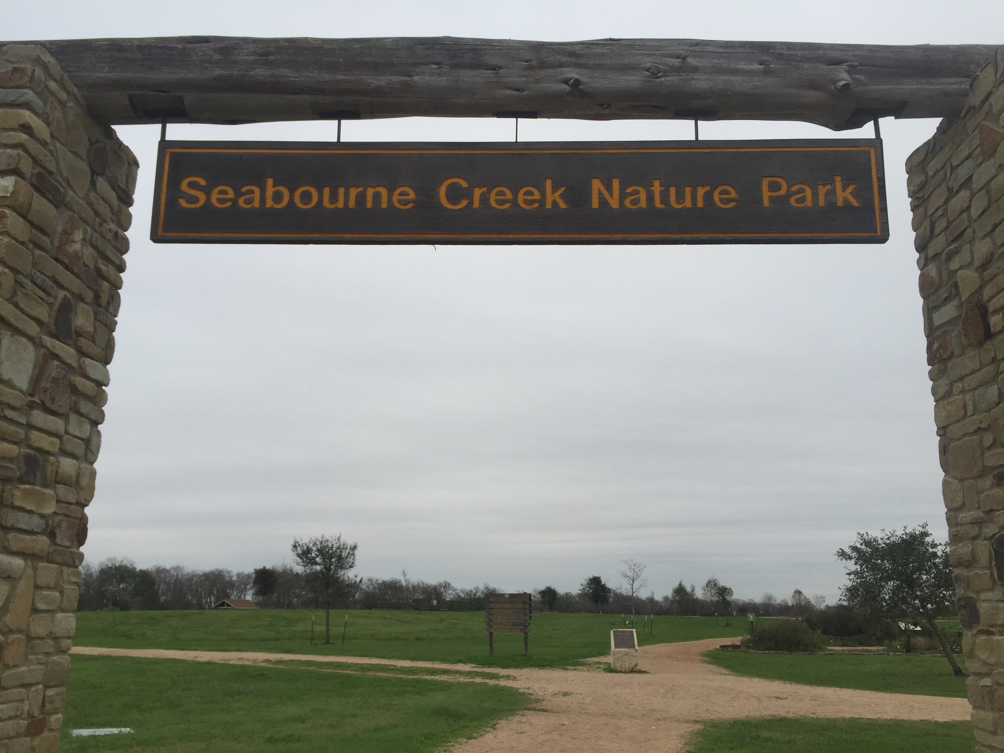 The Seabourne Creek Nature Park in Rosenberg is a good example of a beautiful and inviting green space in the midst of a rapidly growing community. Located on Highway 36, this 164-acre nature park features well-maintained walking, jogging, and biking trails. The Coastal Prairie Chapter of Texas Master Naturalists has contributed to the maintenance of the park and the development of wetlands and prairie restoration areas.
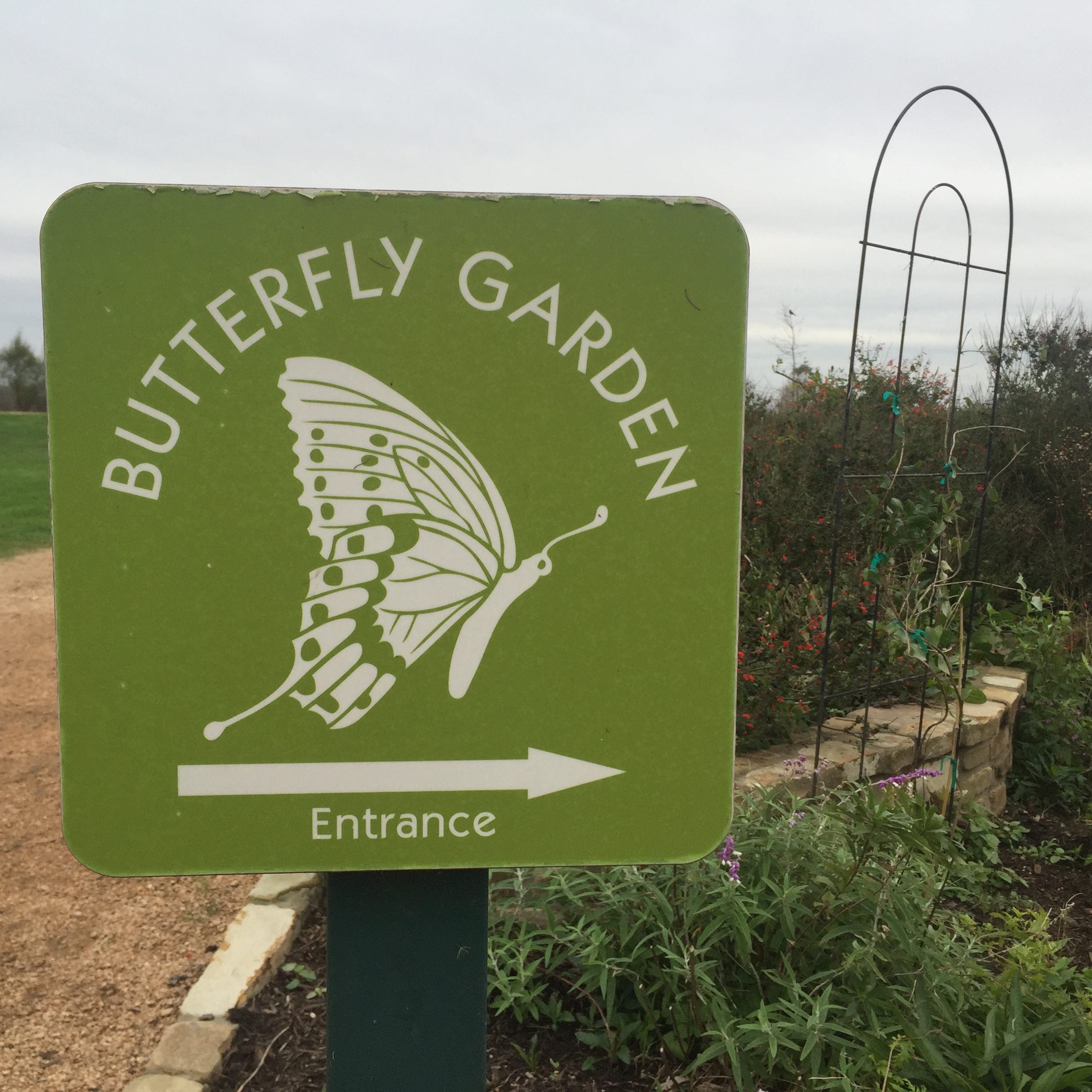 Members of the Coastal Prairie Chapter of Texas Master Naturalists have also created a beautiful butterfly garden, labeled native plant species throughout the park, developed a native grassland demonstration area, and oversee the four-acre lake stocked with bass, perch, and catfish. The work and long-range plans of the chapter will only make Seabourne better and better in years to come.
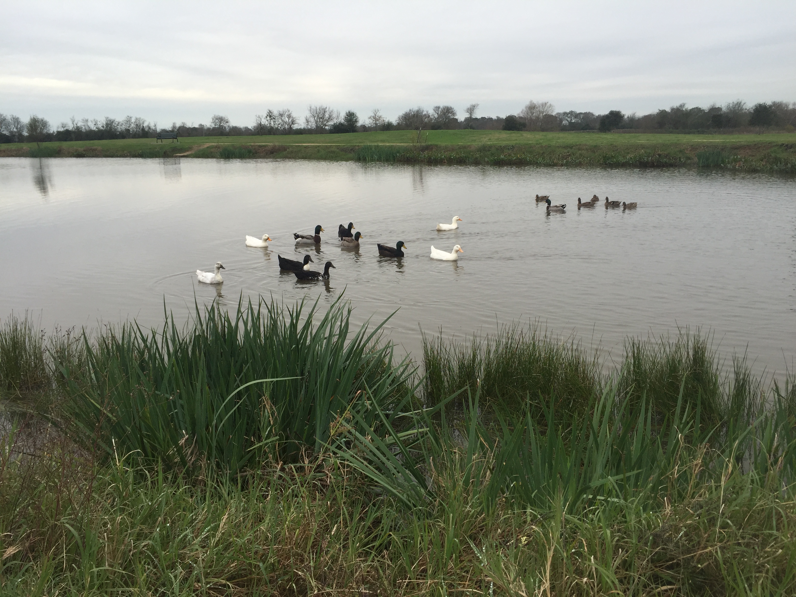 One of the best things about the park is that it is family friendly. This is a great place to take your kids to teach them about the beautiful variety of native plants. On my visit, I enjoyed watching a dad and his young daughter feeding the ducks. There are benches at intervals around the lake where you and your kids can sit and enjoy the wildlife or one of our spectacular Texas sunsets.
 The crushed gravel trails are wide and open to hiking, jogging, and biking. No danger that you will get lost here. Everything is clearly marked. There is an adjacent sports area with a frisbee golf course and baseball and soccer fields. And, as an added bonus, there are actually clean restrooms on site.
 Take a note pad with you if you want ideas about what you will need in order to plant your own butterfly garden or other types of gardens that attract butterflies and birds. Every plant in these gardens is identified by a marker. The various information signs help to make a visit to the park educational.
 Kudos to the City of Rosenberg and their partnership with Texas Master Naturalists to ensure that Seabourne Creek Nature Park remains a family friendly place that residents and guests can enjoy for years to come.
Geographic Center of Texas
Brady, the county seat of McCulloch County, refers to itself as “The Heart of Texas.” That’s because it is the town closest to the geographic center of the Lone Star State. The town was originally named Brady City after Brady Creek, which runs through the town. However, when the town was incorporated in 1906 the name was shortened to Brady.
 The McCulloch Country Courthouse is located in the heart of Brady. Construction of this Romanesque Revival styled building was completed in 1900. One odd feature of the building is that it has no clock in the tower — making its tower truly “timeless.” A marker on the courthouse lawn proudly displays the town’s Heart of Texas moniker.
 One interesting fact about McCulloch County is that during World War 2, there was a German prisoner-of-war camp located three miles east of Brady. After the surrender of General Erwin Rommel’s Afrika Korps in April 1943, three-hundred German prisoners were transported to this camp deep in the heart of Texas. They remained there until 1945 when the United States began the process of repatriating these former prisoners of war.
As for the geographic center of Texas, it is actually located about 20 miles northwest of Brady. A historical marker off Highway 377 states that the actual smack-dab-in-the-middle coordinate is five miles from the marker on a private ranch. I’m sure that working out the location of the geographic center of Texas had its challenges, especially given the Lone Star State’s distinctive shape. The highway marker is as close as most Texans will ever get the the actual geographical center. I’m ok with that.
 Standing at the marker near the point where the imaginary lines that divide Texas intersect was pretty cool. No matter which way you face from this center point, you get the idea that Texas is really big. In fact, fifteen of the fifty states could fit within Texas’ borders with more than 1,000 square miles left over. That’s a lot of space within the state’s distinctive outline.
To give you an idea of the vastness of Texas, the center point of the state is located 437 miles from the state’s most westerly point, 412 miles from the most northerly point, 401 miles from the most southerly point, and 341 miles from the most easterly point. Long distances no matter which way you face and even greater geographical diversity depending on which direction you travel.
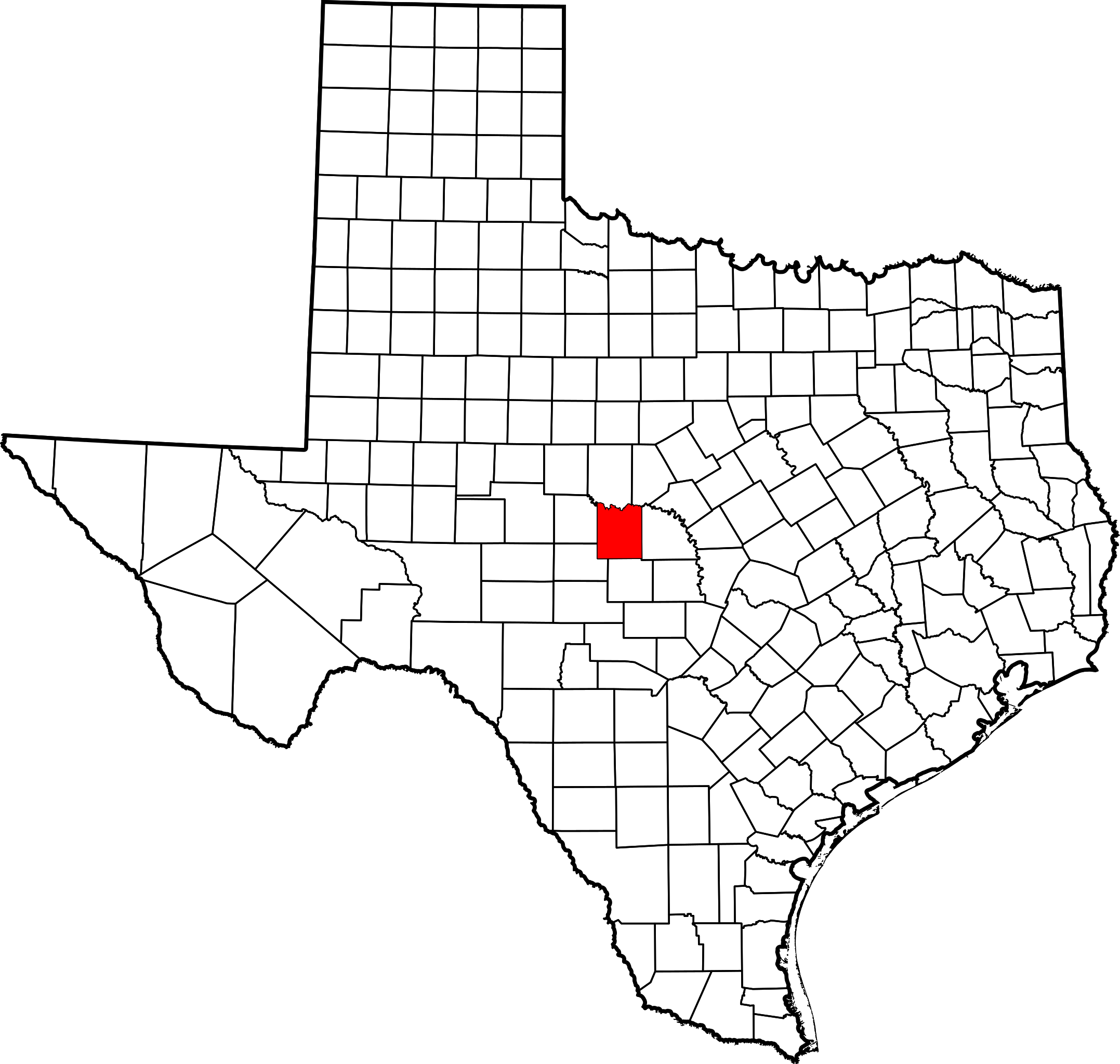 If you happen to have a bucket list of places to see in the Lone Star State, be sure to include a visit to the geographic center of the state. And, of course, be sure to stop in Brady to see its beautiful courthouse. They just don’t build them like that anymore! I’m certainly glad I visited the heart of Texas. As a Texan, I will always have Texas in my heart.
Cadillac Ranch
Cadillac Ranch may just be the quirkiest tourist attraction in the Lone Star State. The old folks up around Amarillo know it as one of the world’s first roadside sculptures — ten Cadillacs buried nose down in a field along old Route 66 west of town. This art project was the brainchild of the late Stanley Marsh 3, an eccentric Texas millionaire. Marsh used the number 3 after his name because the felt that the Roman numeral III was too pretentious. Imagine that!
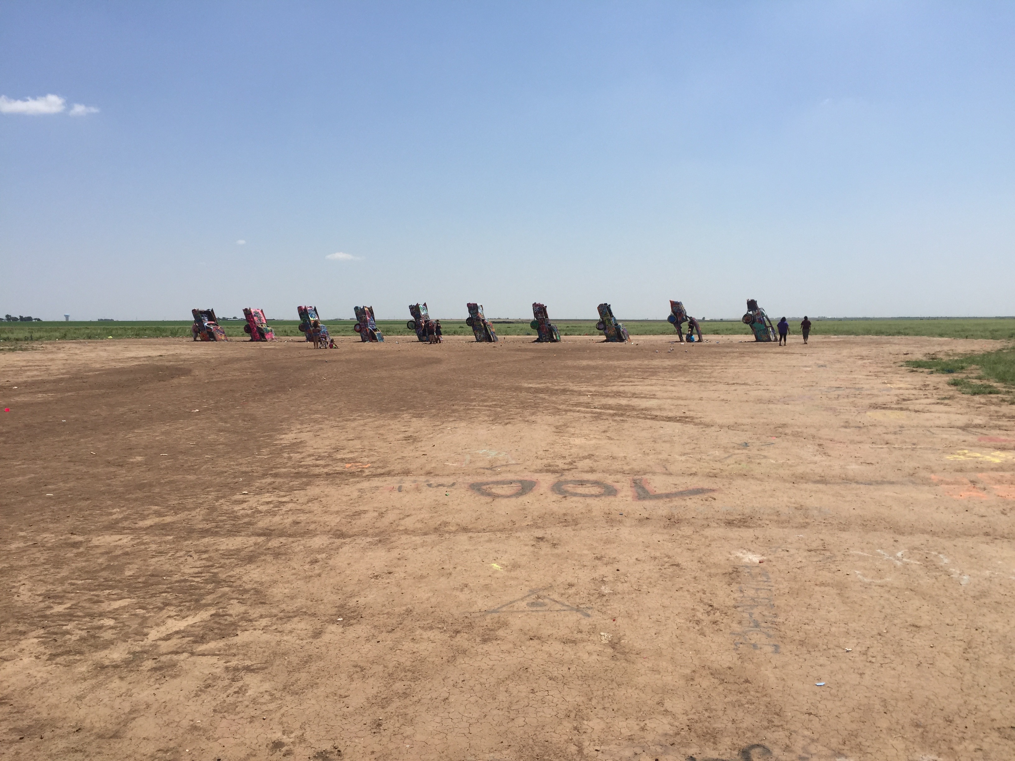 In 1973, Marsh invited a group of artists from California to help him create an unusual work of art, one that would baffle the locals. The hippie artist collective, known as the Ant Farm, was all too happy to help Marsh realize his dream. These guys came up with the idea of burying old Cadillacs nose down in a wheat field owned by Marsh. The Texas millionaire approved the plan and work started in 1974.
 The California artists initially acquired eleven Cadillacs ranging in model year from 1948 to 1963. Most of the cars were purchased from junk yards at a cost of about a couple-hundred bucks each. Only ten of these cars, however, were used. Ten holes were dug and, one by one, each Cadillac was nudged nose first into its partially buried resting place.
 The cars were buried in sequence from the oldest to the newest — all facing west and supposedly at the same angle as the Great Pyramid of Giza. As a result, a legend was born (or perhaps buried). The site immediately attracted the attention of folks traveling down the road and eventually came to be known as Cadillac Ranch.
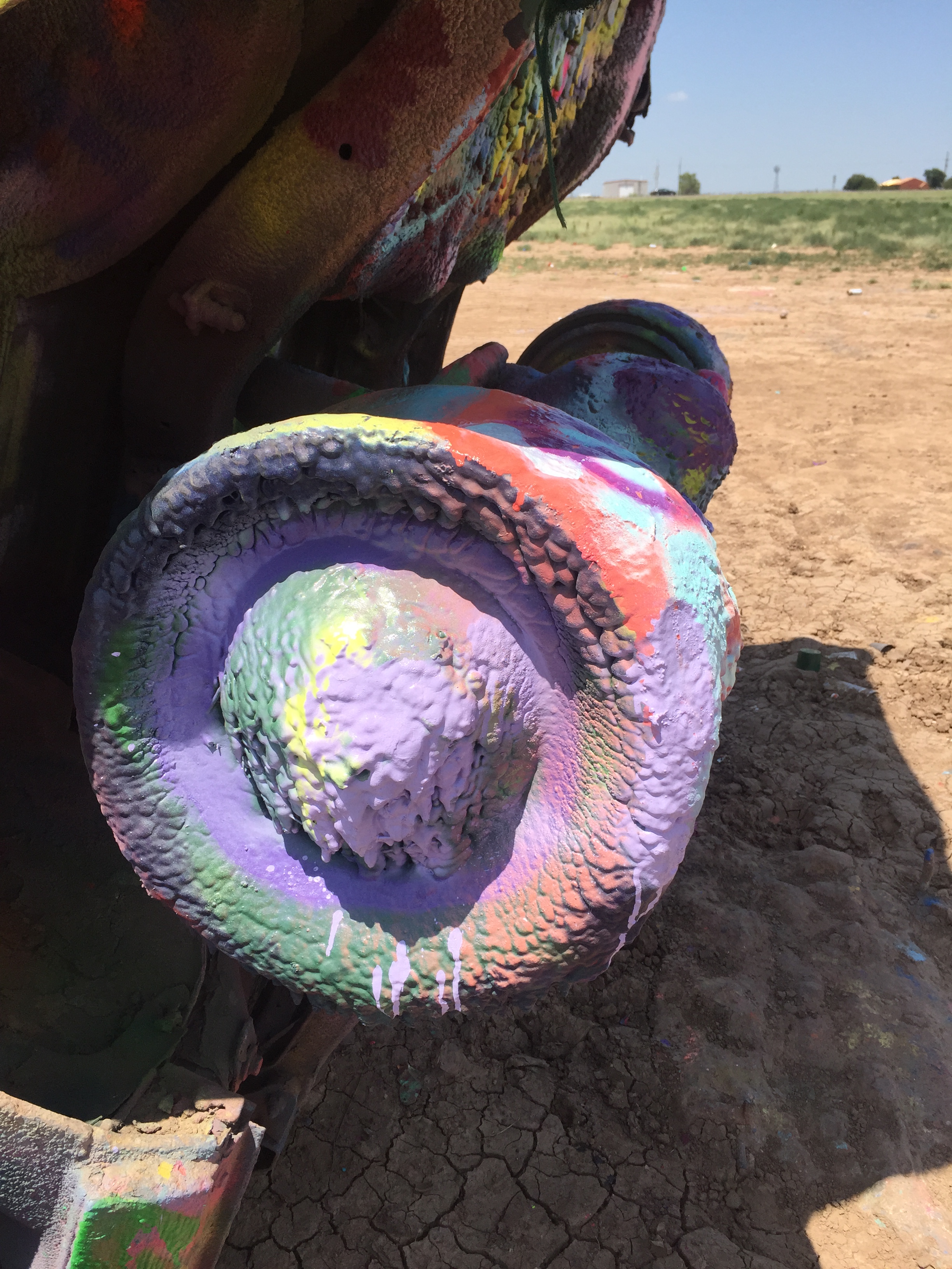 In 1997, the cars were exhumed and moved about two miles to the West because of the encroaching city. This roadside oddity continues to draw tourists and the curious. There is parking along the road and visitors are allowed to bring their own spray paint to add their personal tags to the sculptural oddity. Today, the cars are covered with thick layers of spray paint and ever-changing graffiti, possibly the only thing holding the old cars together.
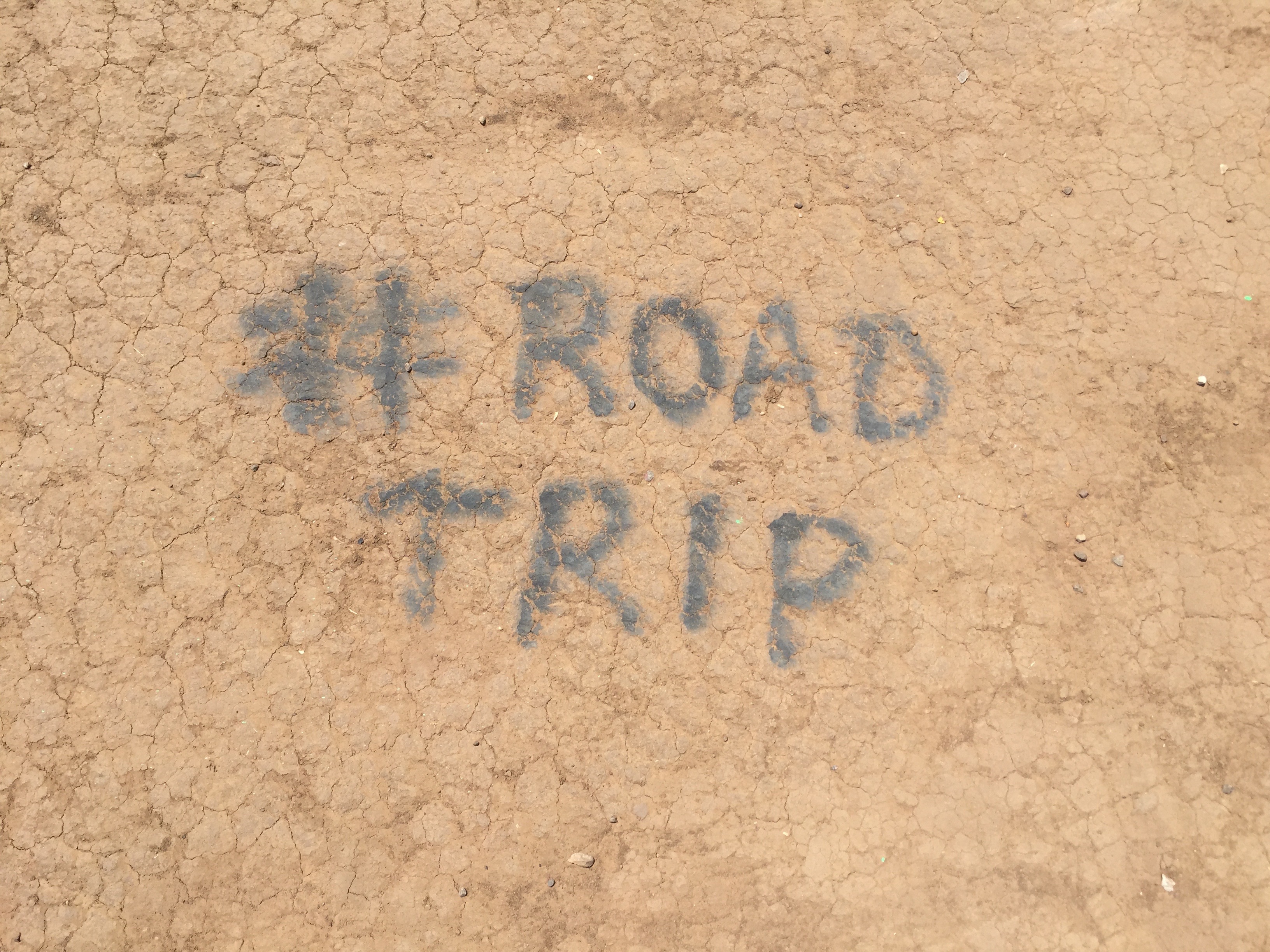 I have visited the Great Pyramid of Giza. And while it’s impressive, it is certainly not as colorful as the old Cadillacs with their tails in the air. Interesting that ten cars buried nose first in a wheat field in Texas likely draw as many or more visitors than the pyramids we all learned about in school. We are definitely drawn to the historical and the comical. And although the quirky roadside attraction will not outlast the pyramids, kudos to Marsh, the patron saint of Cadillac Ranch, for turning an otherwise empty field in the Lone Star State into something to talk about.
The Regency Bridge
Bridges. I love bridges. There is something inherently beautiful about these structures that are designed to connect people and places. Over my years of traveling the world, I have crossed some of the most beautiful bridges on the planet and cautiously ventured across others.
 As a fan of Texas Country Reporter, I have long been fascinated by the one-lane suspension bridge featured in the opening segment of the show — the Regency Bridge. This beautiful bridge spans a remote section of the Colorado River on the Mills-San Saba County line.
 It is, perhaps, a little known fact that Texas has more bridges than any other state in the Union. And, of the more than 52,000 bridges in the Lone Star State, the Regency Bridge is the last suspension bridge in the State that is open to automobile traffic. That alone makes it worth a visit.
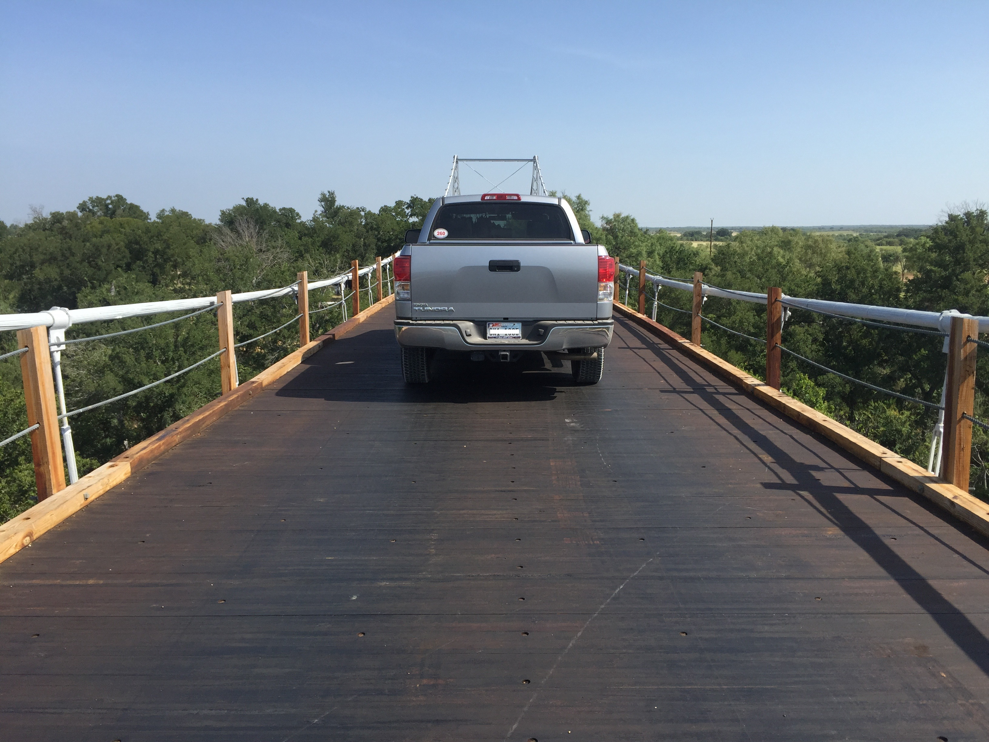 The iconic suspension bridge gets its name from Regency, a now-abandoned farming community on the Mills County side of the Colorado River. The first bridge built at the location in 1903 collapsed under the weight of a herd of cattle. A second bridge was destroyed by a flood in 1936.
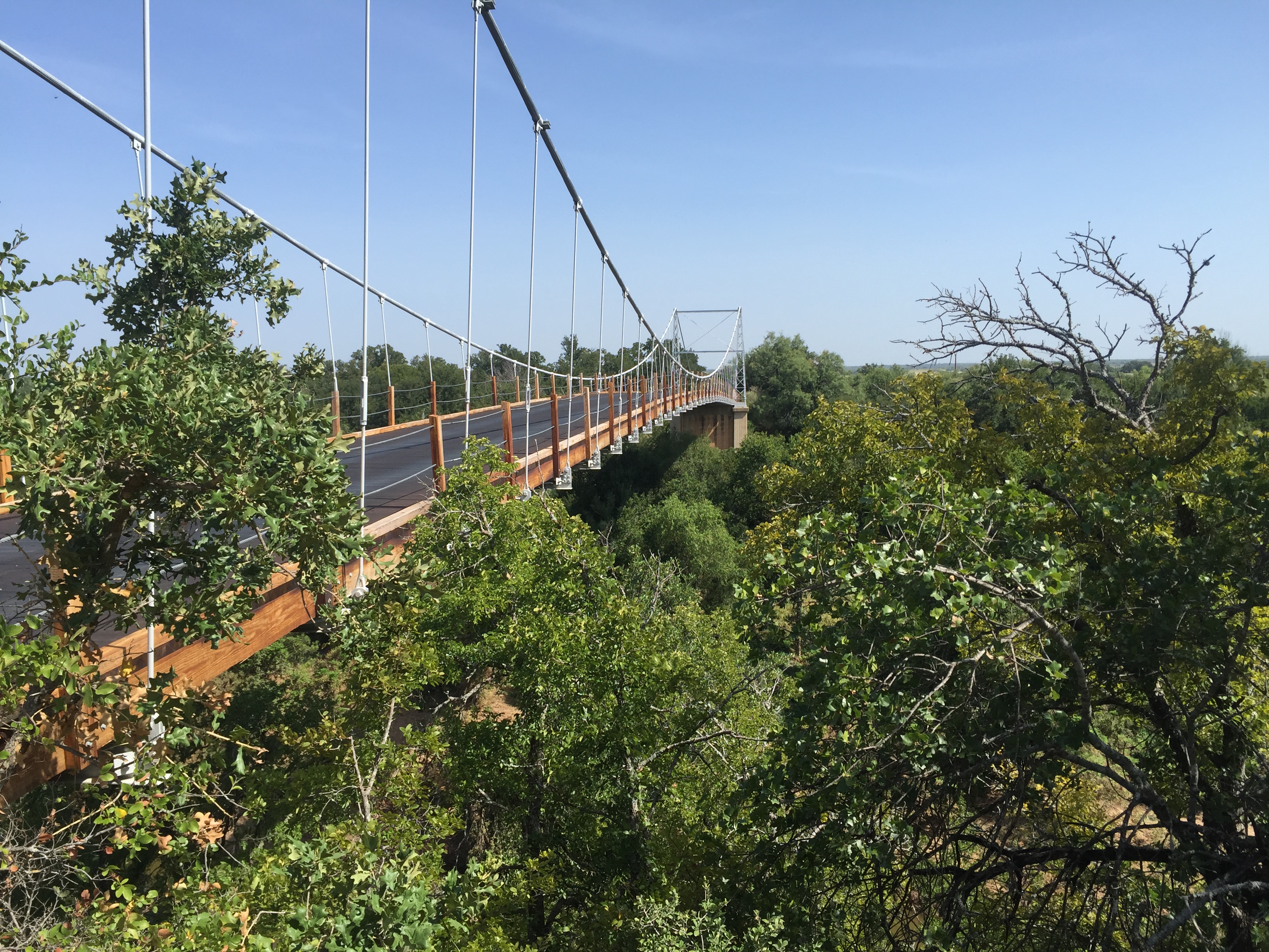 The current Regency Bridge was built in 1939 and repaired and rededicated in 1999. In December 2003, kids shooting off fireworks accidentally started a fire on the wood decking, burning a hole in some of the planks. The bridge was repaired and today remains open to vehicular traffic.
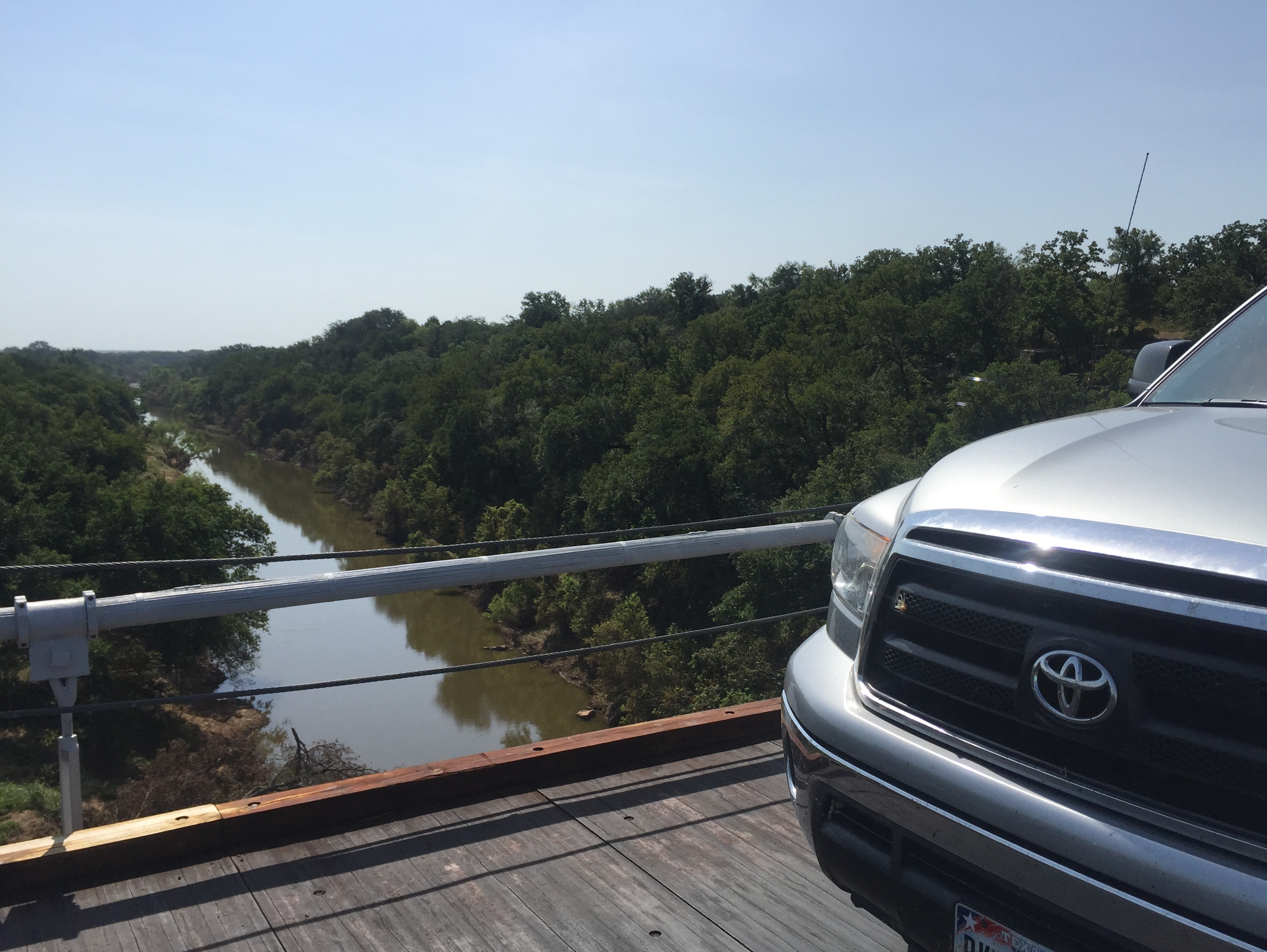 The Regency Bridge is located at the intersection of Mills County Road 433 and San Saba County Road 137, both gravel roads. There is room to park on the Mills and San Saba sides of the bridge. The views from the bridge of the Colorado River and the surrounding countryside are absolutely beautiful.
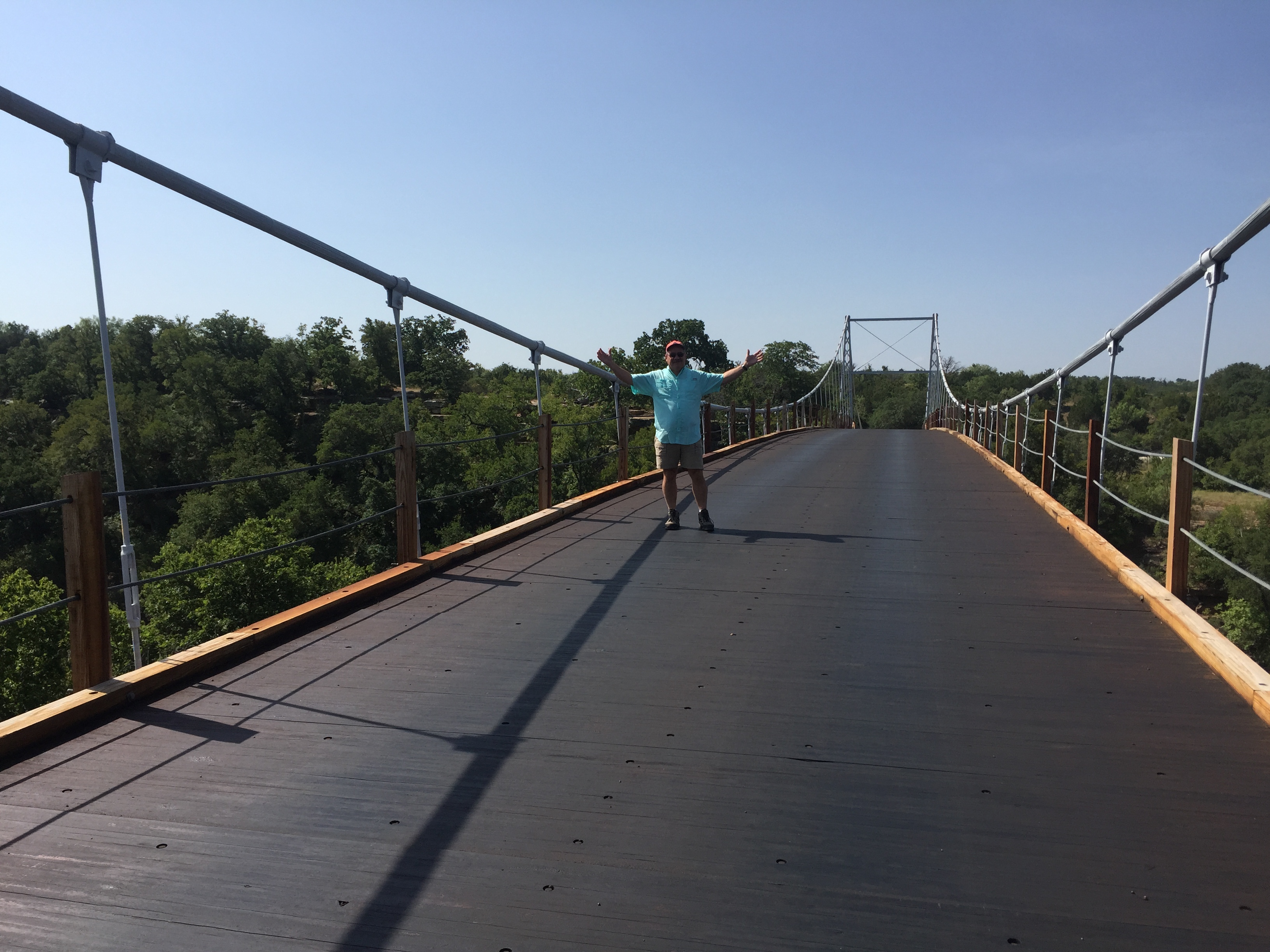 If you find yourself anywhere near the Regency Bridge, make it a point to take a detour to drive across the bridge and to stop and enjoy the scenery. The bridge does not get much traffic because it has been bypassed by newer paved farm to market roads. That makes it even better and possible to enjoy the bridge and the vistas for long uninterrupted periods.

